A record of a cruise on Fred. Olsen's Black Watch in May and June 2015 in three parts:
Part I: Southampton to Trois-Rivières; Part II: Montréal and Québec City;
Part III: Saguenay back to Southampton.
Part I: Southampton to Trois-Rivières; Part II: Montréal and Québec City;
Part III: Saguenay back to Southampton.
Your comments are cordially invited but I reserve the
right to delete any I consider inappropriate.
right to delete any I consider inappropriate.
Robert Cutts, August 2015
Some links connect to articles originally written for Wikipédia
français. Most have an option to translate them into English in the left column. If there's no
such option in Wikipédia and other French articles, links take you to Google’s English translation. In such
cases there is usually an option at the top of the page by which you can convert back to the original
language.
Click on images for higher-resolution views and press Esc to return here.
As you read, please click on the links for additional information.
Use the browser back arrow to return from a linked site.
Scenic Cities and Landscapes of Canada
A Fred. Olsen Black Watch Cruise
Part I: Liverpool to Trois-Rivières
From 22 May to 19 June 2015 my wife Pauline and I were on board Fred Olsen's Black Watch on a cruise called Scenic Cities and Landscapes of Canada.
She was the same ship that had taken us earlier in the year round South America. That time she departed from
Southampton. This time it was Liverpool. The City has a very
great maritime past. Among British ports, in her heyday, she was second only to London. Now, in terms of
freight tonnage, she is down to being the fifth biggest port after Felixstowe, Dover, London and Grimsby. As a
passenger port in the early 20th century she ranked alongside London and above Southampton. Although P & O had
their headquarters in London, both Cunard and White Star were based in Liverpool. Furthermore, in 1914, Cunard built
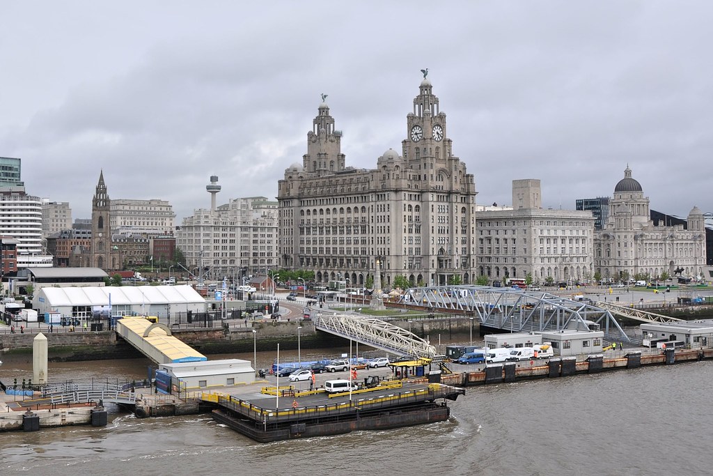
an impressive new headquarters on the City's Pierhead:A Fred. Olsen Black Watch Cruise
Part I: Liverpool to Trois-Rivières
The Cunard Building, Pierhead, Liverpool (MrHope, Wikipedia)
The building is still in place but, symptomatic of Liverpool's decline, Cunard moved their headquarters to Southampton in 1967.
Nowadays virtually all ocean-going passenger ships are cruise liners. As a cruise-line terminal for UK passengers, Southampton dominates with about 1,500,000 per year whilst Dover and Harwich each have about 150,000 per year. All other ports together account for only 130,000 passengers per year so, as a cruise terminal, in terms of passengers on cruise liners departing and arriving from the UK, Liverpool is tiny. However, she is doing well as a place for cruise liners to visit. At present, larger vessels have to anchor offshore and take passengers in by tender but, in spite of that, the city attracted 80,000 international visitors during 2014. That's not surprising as Liverpool is a much more interesting place to visit than Southampton, Dover and Harwich put together.
Liverpool, Thursday 21 and Friday 22 May
Realising the attractions of Liverpool as a place to visit, we took a coach to the city on 21 May – the day before our ship was due to depart – and took the opportunity to have a look round. Mind you it was by no means the first time we had visited the city. Strangely, amongst the passengers on our coach were the parents of Hereford-born Jackie Probert-Isagre who was a first-time cruise director on the Black Watch during our South American cruise. They, like us, were to join the ship in Liverpool.
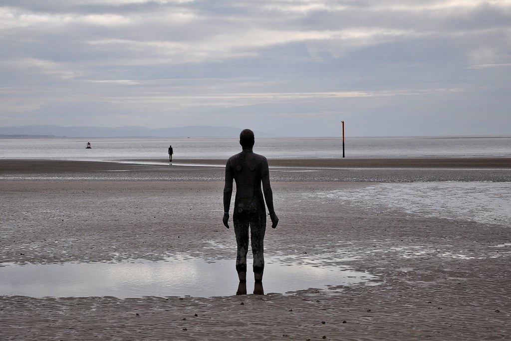
On Thursday we visited Crosby to have a look at Antony Gormley's 'Another Place'.There we saw some of his one hundred cast-iron sculptures facing towards the sea. Here are two of them:
Anthony Gormley's 'Another Place' in Crosby
To enlarge this or any other image click on it. If you're using a laptop, not
only will you see a larger version of the photo but, using the arrow keys or
the mouse wheel, you will be able to scroll through all the other photos.
To return to the blog, press the escape key.
To return to the blog, press the escape key.
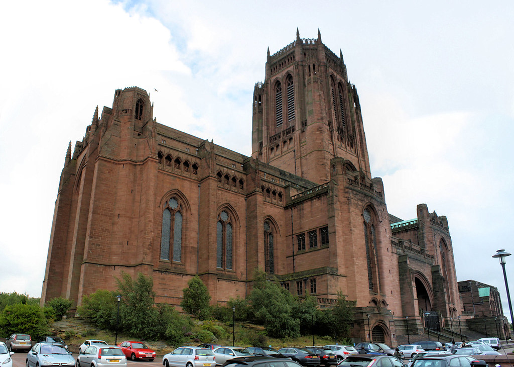
On Friday we looked round the city before we joined the ship. One of the buildings we saw was Liverpool's Anglican Cathedral:
Liverpool Anglican Cathedral
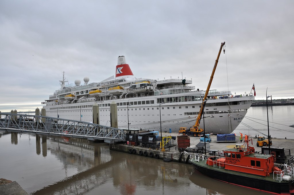
We couldn't resist going down to the cruise terminal to make sure that the ship was in port.
We needn't have worried!
'Black Watch' berthed at Liverpool Cruise Terminal
The leaving of Liverpool
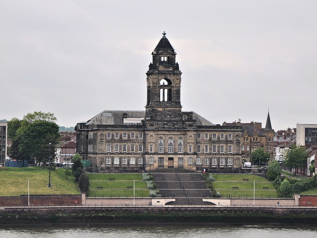
As we drew away from Liverpool, over the water on the Wirral side we could see the rear of Wallasey Town Hall in the distance:
Wallasey Town Hall
A couple of days after we departed a big maritme event took place in Liverpool. To celebrate the 175th Anniversary of the Cunard Line, the City received visits from their three current Queens: Elizabeth, Mary and Victoria. At present the terminal can only take one ship at a time so the Queens anchored offshore.
The three Cunard Queens in Liverpool 24-26 May 2015
At sea, Saturday 23 to Monday 25 May
We were at sea for three days sailing in a south-westerly direction towards the Azores. The sea was calm and the sky was partially clouded but there was no rain. It being only six weeks since we were last on the ship we weren't surprised to find that many of the crew who had been been on the ship during the South American cruise were still there. We were particularly pleased to renew our acquaintance with the resident pianist, Ronnie, and our former waiters, Juan, Sanit and Mark. Although the bridge hosts were not the same as on the South American cruise, we had met them on a previous cruise to Norway. They were Paul and Val Ruston. Not only were they excellent bridge hosts but also very good company and we got on with them very well. Pauline was persuaded to join in all the duplicate sessions during the sea-day afternoons. That was quite unprecedented! Paul and Val also joined our quiz team in the evening. We got close to the winning score on a number of occasions but never actually won!
As on the South American cruise, we joined the 50-strong choir and had one hour’s practice every sea-day morning. The choirmaster, Tony Metcalfe, and his wife, Ann, made a splendid combination. Tony reminded me very much of Alan Bennett having the same dry Yorkshire humour. The songs chosen were interesting. Several had Liverpool connections. Amongst those were The Leaving of Liverpool and the Beatles song, Let it be. There were two or three gospel songs including It's me O Lord. On the first day, Tony played a tune on the piano and asked if we knew what it was. Nobody did! But we soon found out when he handed out the songsheet for it – and we all grew to love the Canadian National Anthem. On the last day of the cruise we gave a concert to the other passengers. It included seven or eight of the songs we had practised.
Ponta Delgada, Tuesday 26 May
A larger cruise terminal for Liverpool is currently rumoured to be on the drawing board.
At sea, Saturday 23 to Monday 25 May
We were at sea for three days sailing in a south-westerly direction towards the Azores. The sea was calm and the sky was partially clouded but there was no rain. It being only six weeks since we were last on the ship we weren't surprised to find that many of the crew who had been been on the ship during the South American cruise were still there. We were particularly pleased to renew our acquaintance with the resident pianist, Ronnie, and our former waiters, Juan, Sanit and Mark. Although the bridge hosts were not the same as on the South American cruise, we had met them on a previous cruise to Norway. They were Paul and Val Ruston. Not only were they excellent bridge hosts but also very good company and we got on with them very well. Pauline was persuaded to join in all the duplicate sessions during the sea-day afternoons. That was quite unprecedented! Paul and Val also joined our quiz team in the evening. We got close to the winning score on a number of occasions but never actually won!
As on the South American cruise, we joined the 50-strong choir and had one hour’s practice every sea-day morning. The choirmaster, Tony Metcalfe, and his wife, Ann, made a splendid combination. Tony reminded me very much of Alan Bennett having the same dry Yorkshire humour. The songs chosen were interesting. Several had Liverpool connections. Amongst those were The Leaving of Liverpool and the Beatles song, Let it be. There were two or three gospel songs including It's me O Lord. On the first day, Tony played a tune on the piano and asked if we knew what it was. Nobody did! But we soon found out when he handed out the songsheet for it – and we all grew to love the Canadian National Anthem. On the last day of the cruise we gave a concert to the other passengers. It included seven or eight of the songs we had practised.
Ponta Delgada, Tuesday 26 May
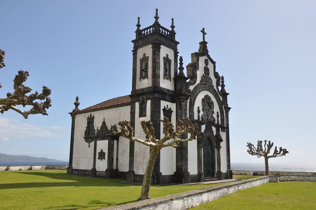
We arrived at Ponta Delgada, the capital of the Portuguese island of São Miguel in the Azores. In fact, that was our last port of call during our South American cruise and the photos that I took during that visit can be seen here. It often rains there but, like on our previous visit, we were lucky. The weather stayed fair all day. We didn’t mind the repeat visit at all as Ponta Delgada has many examples of Portuguese architecture and we certainly didn’t see them all on our first visit. Ermida da Mãe de Deus (the Hermitage of the Mother of God), situated on a hilltop to the West of the city, is a little bit off the beaten track but well worth a visit:
Ermida da Mãe de Deus, Ponta Delgada
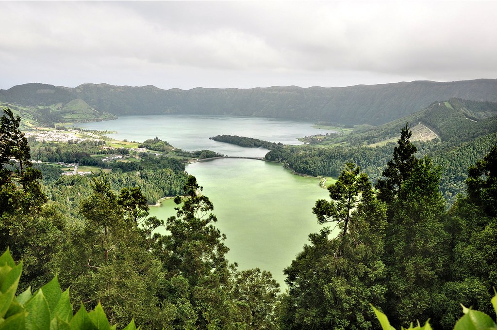
One thing we didn't do during a previous visit to Ponta Delgada was to visit Lagoa das Sete Cidades close to the eastern tip of the island. We made that good on our second visit. To quote from Wikipedia, "Lagoa das Sete Cidades, or the Lagoon of the Seven Cities, is a twin-lake situated in the crater of a massive volcano on the island in the Portuguese Archipelago of the Azores. It consists of two ecologically-different lakes connected by a narrow passage and crossed by a bridge and is located inside a dormant volcano in the far east of the Island of São Miguel. The nearer lake is known as the Green Lake and is indeed living up to its name". Unfortunately, at the time of our visit, the sky was grey so the more distant "Blue Lake" was not as blue as it can be.
Lagoa das Sete Cidades, São Miguel
Sunday 31 May
The ports we visited in Canada
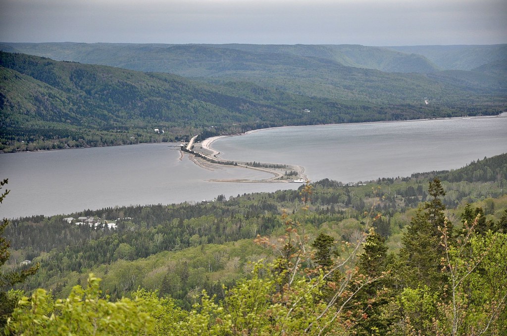
After four days at sea we reached our first Canadian port of call, Sydney in Cape Breton Island. A party of six of us went in a taxi to the Alexander Graham Bell Museum in Baddeck. The official Fred Olsen excursion to Baddeck would have cost us £75 each. Our visit cost half that and we were able to be more flexible. For example, we spent longer at the museum than did those on the official excursion.
On our way to the museum we passed Dalem Lake:
Dalem Lake
I only knew about Bell as being the inventor of the telephone. But, in this well laid out museum, we discovered that he also contributed to the education of the deaf, sound transmission, medicine and aeronautics. In fact, working in Baddeck during the early 20th century, he headed a team that experimented with powered aircraft and, on 23 February 1909 a member of his team, John McMurdy, made Canada's first powered flight in a heavier-than-air machine called the Silver Dart. A replica of the machine is in the museum:
The Silver Dart in the Alexander Graham Bell Museum
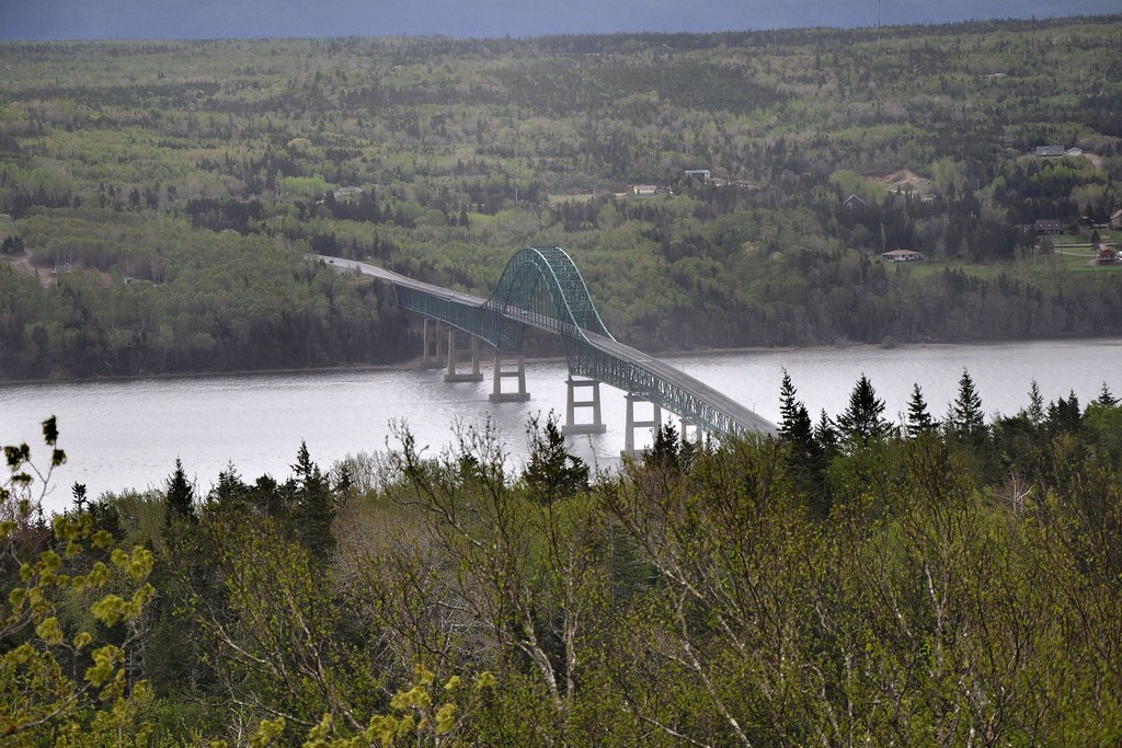
On our way back to Sydney we got a good view of the Seal Island Bridge before we crossed it:
Seal Island Bridge
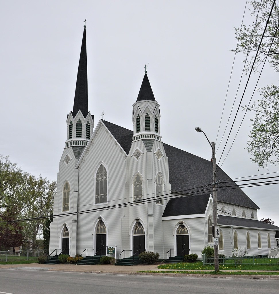
Back in Sydney we had a look round the place. and were particularly struck with the Roman Catholic Church of the Sacred Heart:
The Church of the Sacred Heart, Sydney
The wooden church celebrated its last mass in June 2014, but it had been arranged that it would be reopened occasionally during the summer of 2015 so that cruise ship passengers could visit it. Unfortunately our visit did not correspond to one of those occasions.
Charlottetown, Monday 1 June
From Sydney we sailed to Charlottetown the capital of Canada’s smallest province, Prince Edward Island. Charlottetown has only space for one moderately sized ship to berth and we were scheduled to to take that up. But as we approached it became apparent that the place had been taken up by a cargo ship and that we would therefore have to anchor offshore. Our captain was not pleased, but there was nothing he could do about it. It meant, of course, that we had to be taken to and fro from the ship to the city by tender – a time-consuming exercise.
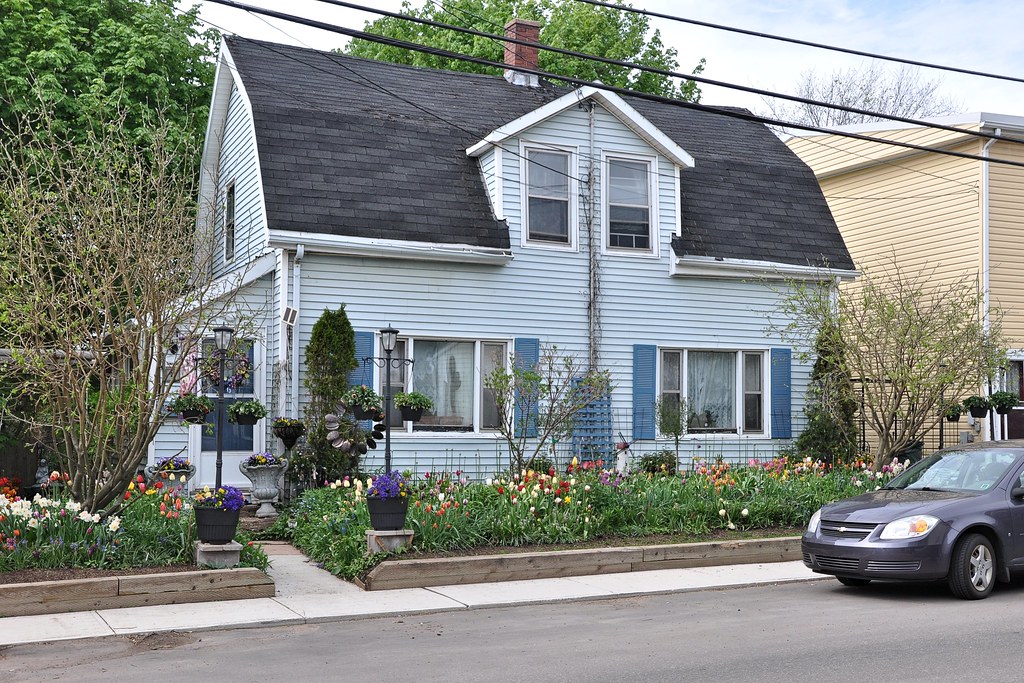
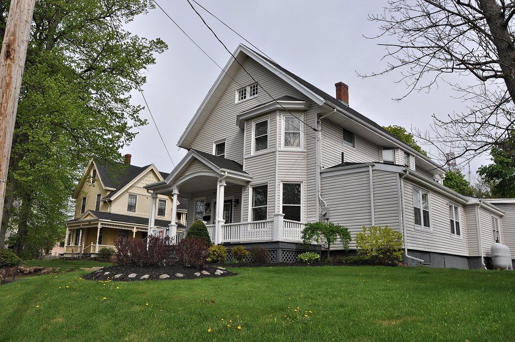
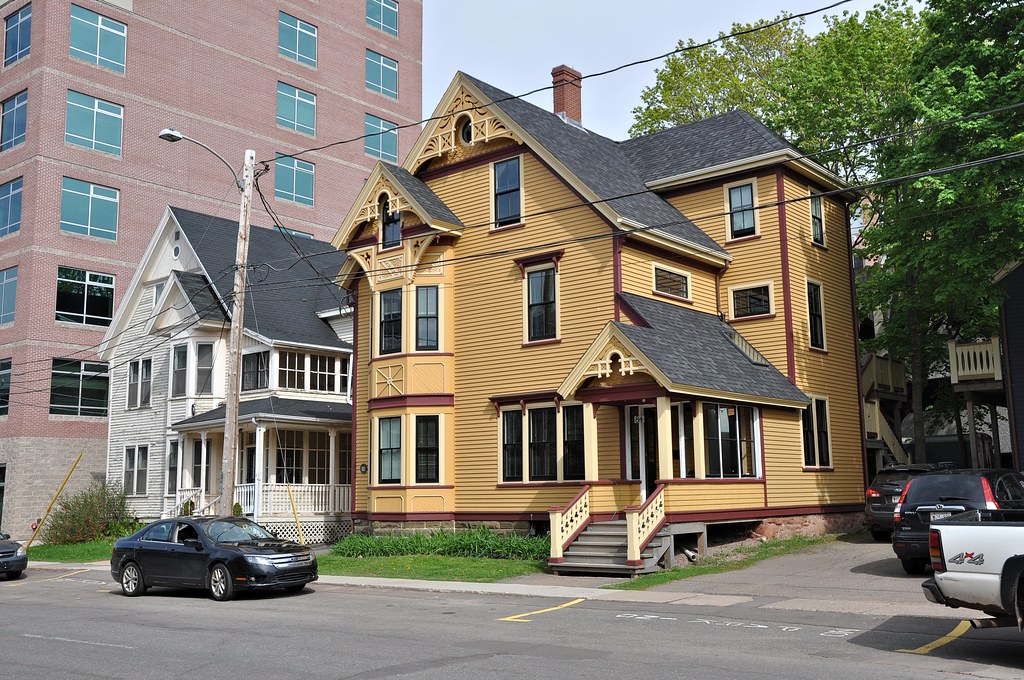
Charlottetown was named after Queen Charlotte, wife of King George the third, and was incorporated in 1855. But its roots date back to the mid-1700s. Almost all of the private houses were of wood – and none the worse for that. They were all of elegant design and every single one was different. Here are some examples:
A house in Euston Street
Another house in Euston Street
Houses in Fitzroy Street
West Street
As with all images, left click to see a higher resolution version
of the map. To return to the blog press the escape key.
of the map. To return to the blog press the escape key.
Our tour of the city started with Water Street which runs parallel to the shoreline from south-west to north-east. The first building we saw was the Water Prince Corner Shop:
The Water Prince Corner Shop
Walking along Water Street we soon reached one of Charlottetown's main thoroughfares, the historic, tree-lined, Great George Street. As we walked it we saw the red-brick Customs House on the right:
The Customs House
Shortly after, on the left was St Dunstan's Basilica. St Dunstan (909-988) was born in Somerset and, after serving as Bishop of Worcester and then of London, became Archbishop of Canterbury in 959 until his death. The Basilica named after him was built in 1960 and was designated as a National Historic site of Canada in 1990. This is a view of it from the opposite side of the street with, in the foreground, a statue recalling an unusual moment in Charlottetown's history:
St Dunstan's Basilica and the two John Grays
In September 1864 23 delegates met at a City Conference. Two of them, both conservatives, had precisely the same name: John Hamilton Gray. The statue commemorates their meeting.
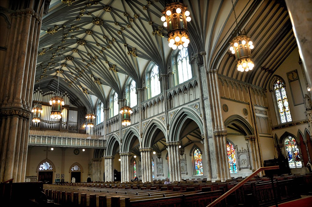
Unlike the Church of the Sacred Heart in Sydney, St Dunstan's was open. Here's a shot of the interior:
St Dunstan's Basilica
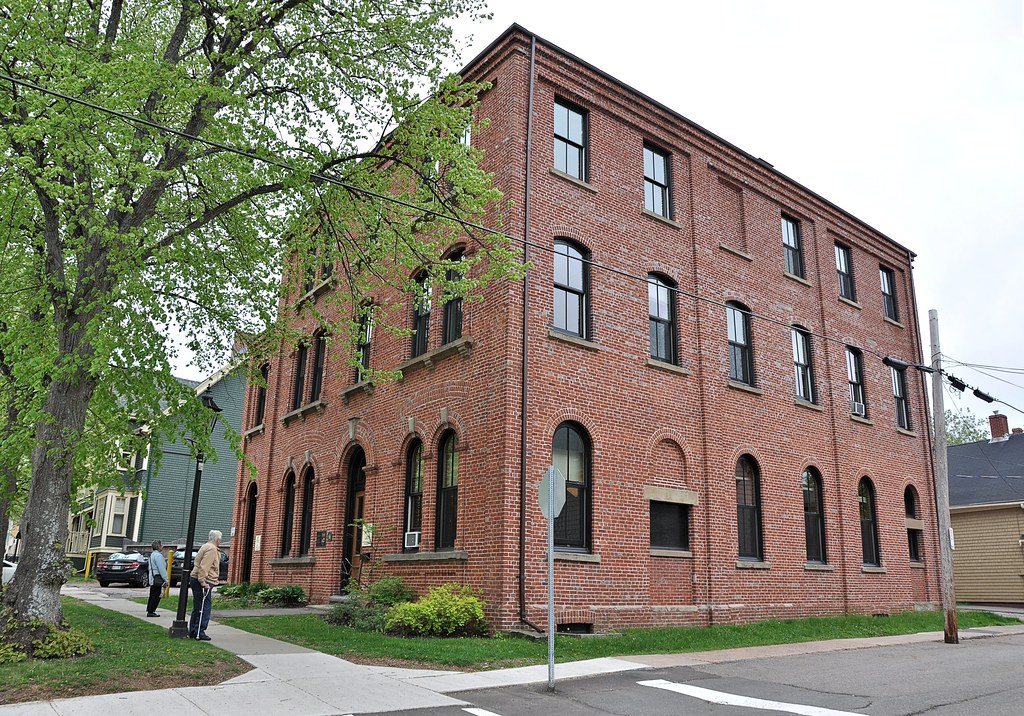
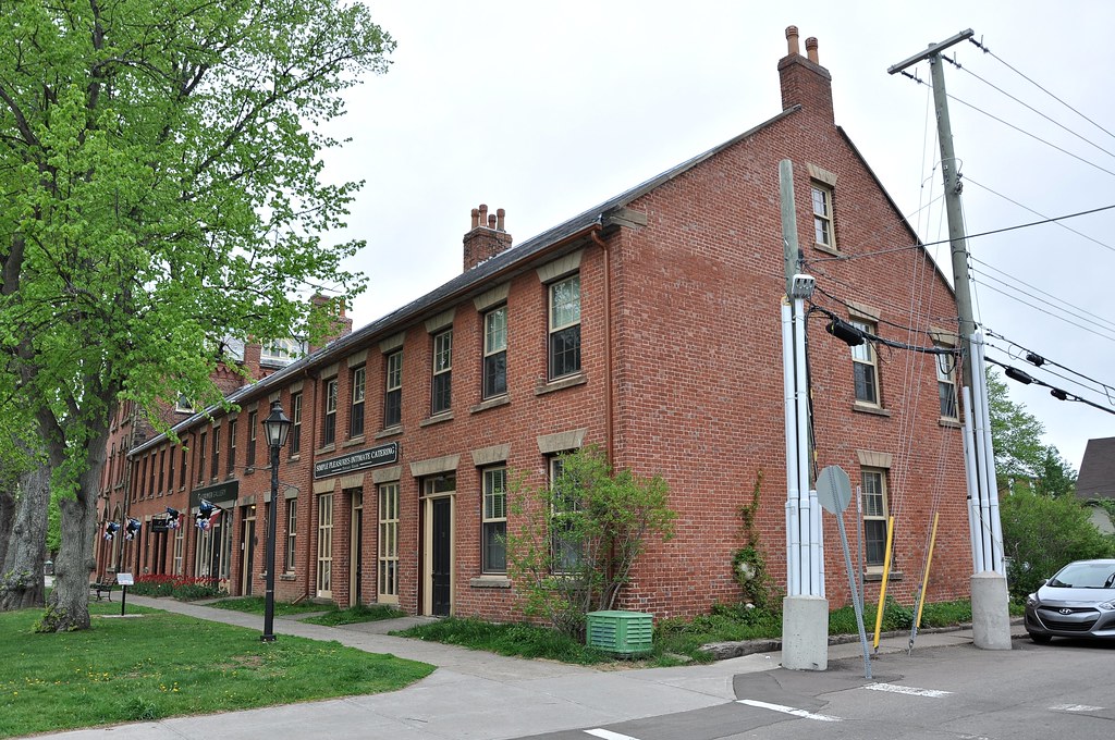
On the right a little further along Great George Street is a short terrace of shops known as Heartz-O`Halloran Row:
Heartz-O`Halloran Row
At one time it was the home of two families that had emigrated to Charlottetown in the early 19th century. Richard Heartz was of German origin and the O'Hallorans were from Dublin. In the mid-20th century the building was damaged by fire but in the nineteen seventies it was restored by the Heritage Canada Foundation.
By now we were halfway along Great George Street and in front of us we could see Province House, an imposing building with a raised Doric portico. It lay transversely across Great George Street dividing it into two separate thoroughfares. Before walking round the building we took a look back along Great George Street:
Great George Street
St Dunstan's is on the right and, on the left, is the Union Bank Building with Heartz-O`Halloran Row just visible beyond it.
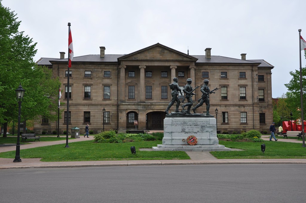
The cornerstone of Province House was laid in 1843 and it's where the Prince Edward Island legislature has met since 1847. Walking round it, we saw that the rear was exactly like the front. However, the war memorial was behind the building, so a photo taken from that angle combines two interesting features of the city:
Province House
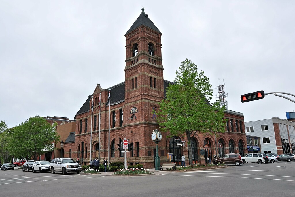
The buildings on the far side of Great George Street were of less interest so, reaching Kent Street we turned left and soon reached Queen Street. There we saw Charlottetown's City Hall. The seat of the city council, it was built in 1888 in the Romanesque revival style:
The City Hall
Continuing along Kent Street we saw the Rodd Charlottetown on the left:
The Rodd Charlottetown Hotel
The hotel was built by the Canadian National Railway in 1931 but it was sold to Rodd Hotels and resorts in the early 1980s.
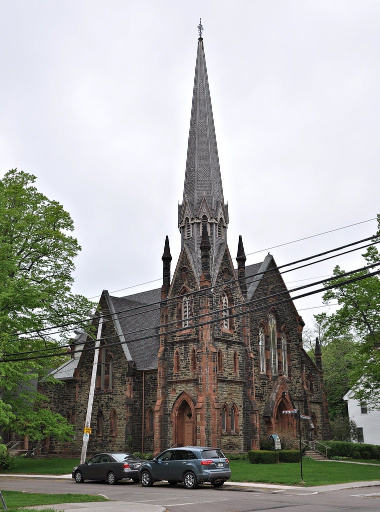
We continued along Kent Road until, on reaching Pownal Street, we turned right. Shortly, at the junction with Fitzroy Street, we saw the Presbyterian Kirk of St James:
The Presbyterian Kirk of St James
The cornerstone of the church was laid in 1877 and dedication took place a little over a year later.
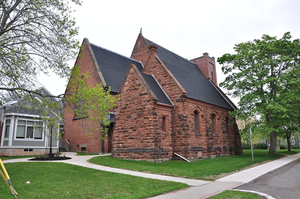
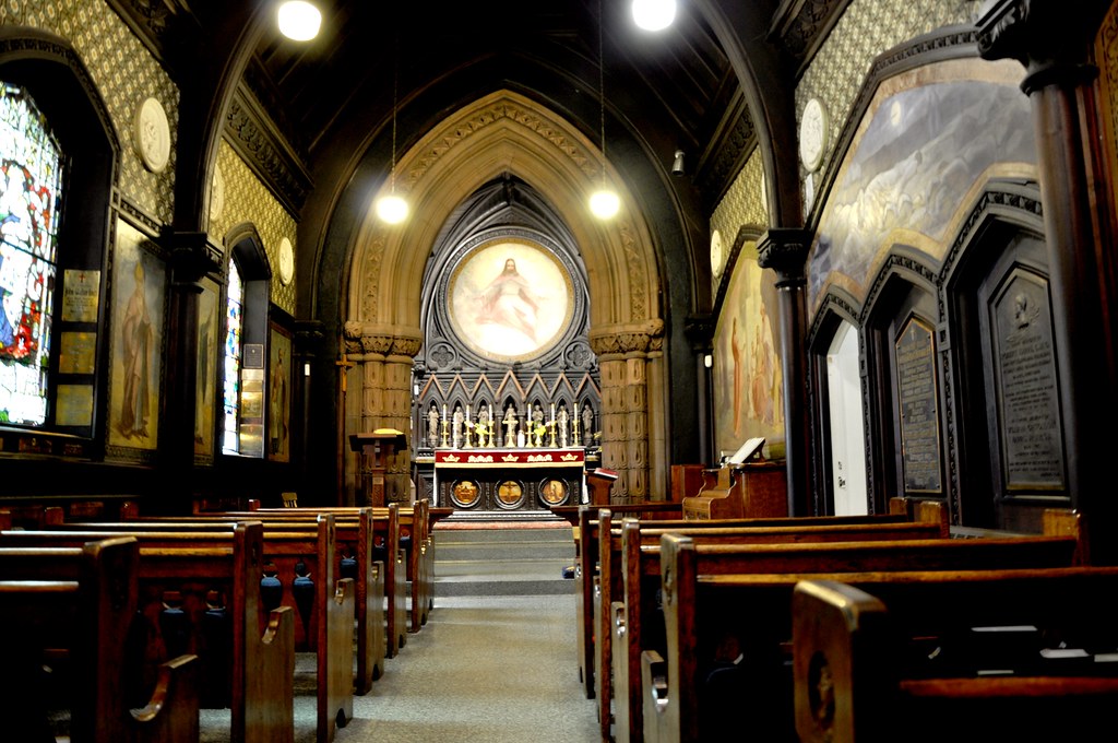
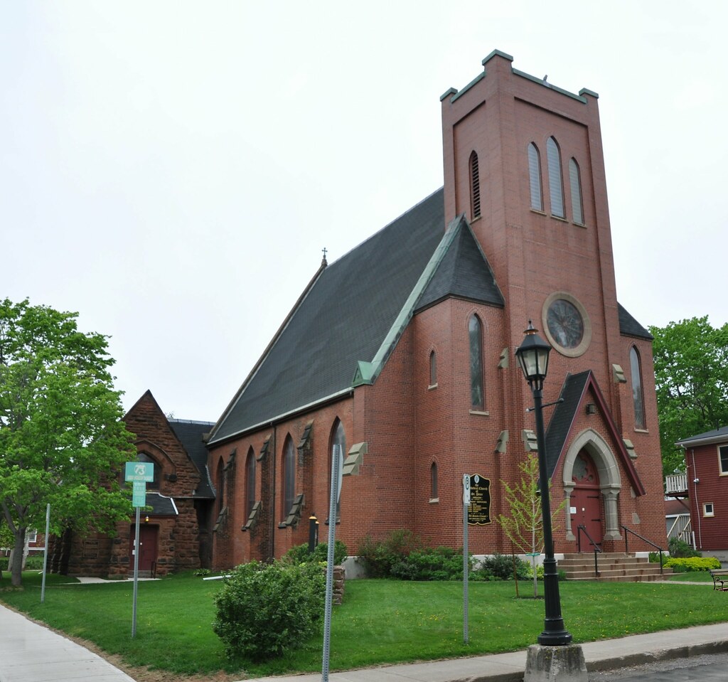
Turning left into Fitzroy Road we walked to the next road, Rochford Street. At the next junction we saw All Souls' Anglican Chapel which adjoins St Peter's Anglican Cathedral. The cathedral was closed but we were able to see the interior of the chapel.
All Souls Anglican Chapel
The interior of the chapel
St Peter's Anglican Cathedral
The chapel is in Victorian Gothic revival style and was dedicated in 1888. The Cathedral, though more modern in style, was actually built 20 years earlier than the chapel. It lies at the corner of Rochford Square, a mini park with trees and flowers in abundance:
Rochford Square
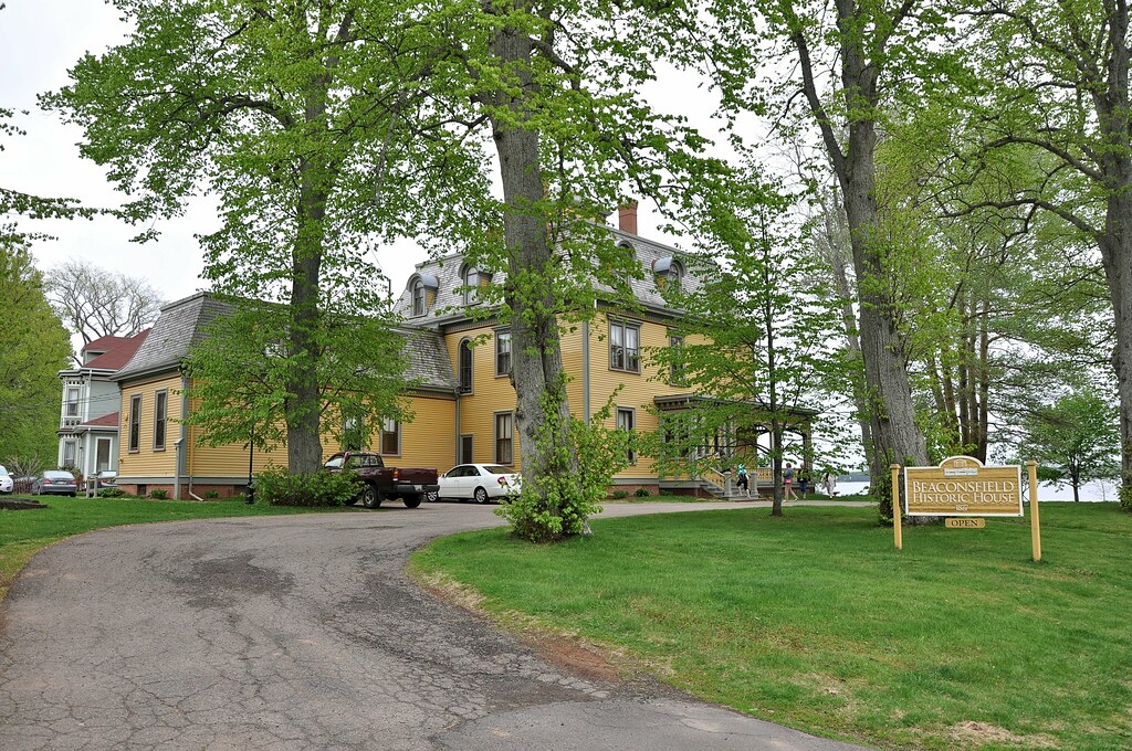
We were now back in Kent Street, so we continued in the direction we were going to West Street where Beaconsfield House is located. It was built in 1877 and is one of Charlottetown's most elegant homes. It's now open to the public for guided tours, lectures and concerts.
Beaconsfield House
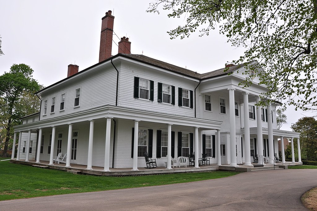
Government House
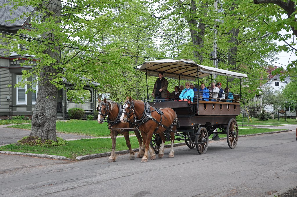
By the time we left government house it was time for lunch, so we wended our way back to the ship. As we walked along West Street we saw one of the many horses and carts that were almost certainly carrying fellow passengers on a city tour, We recognised one or two of them!
Black Watch passengers on a traditional horse and cart in West Street
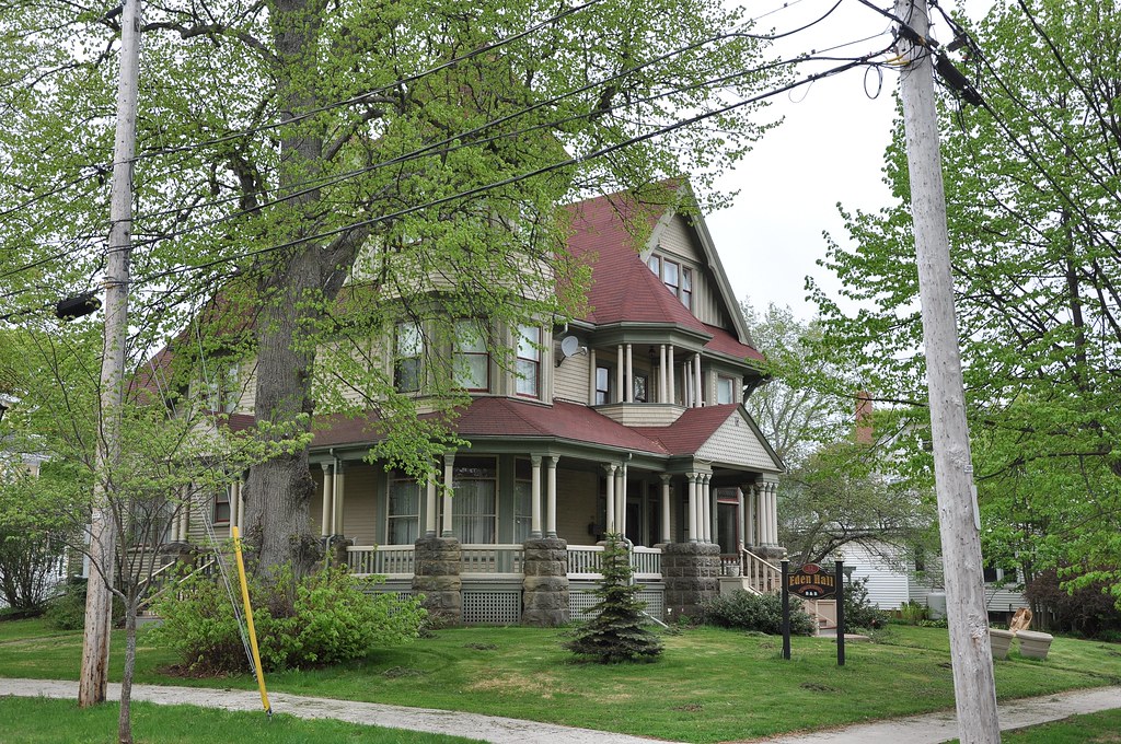
Also in West Street we saw Eden Hall, yet another large and elegant Victorian dwelling place:
Eden Hall
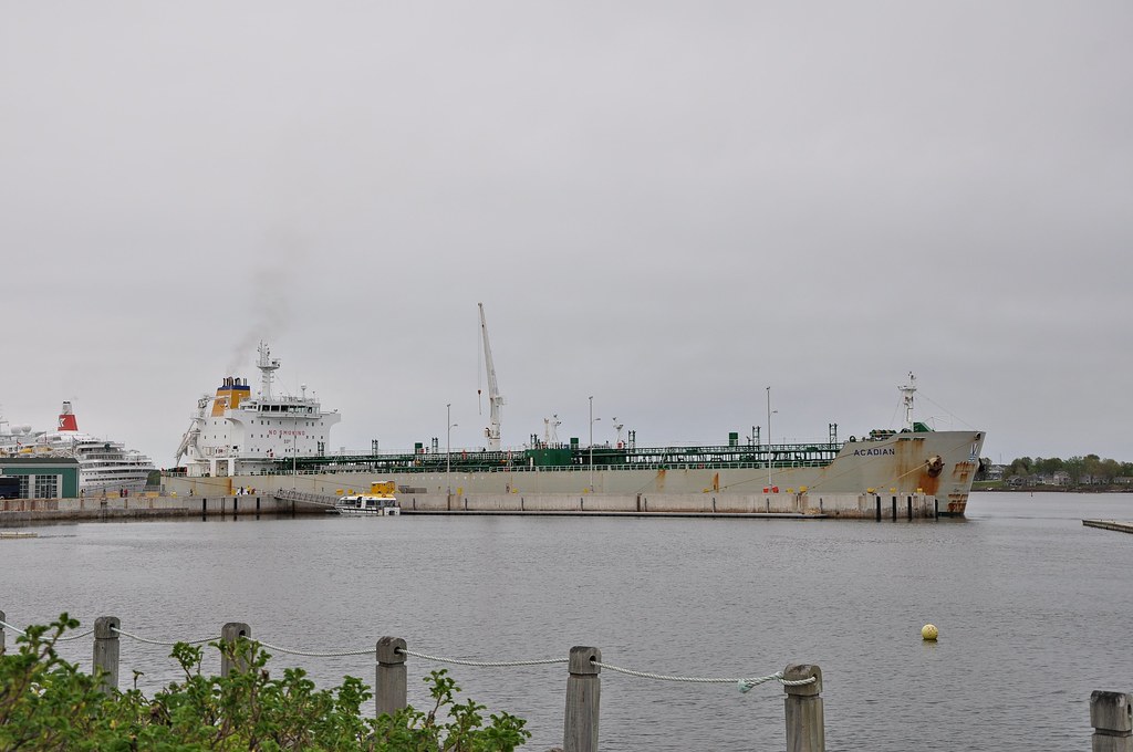
As we approached Black Watch, we saw the cargo ship that had taken our place on the quay:
The oil tanker 'Acadian'
From the photo it looks as if Black Watch is berthed immediately aft of Acadian. In fact Black Watch was anchored offshore and there was about a hundred yards of water between the two ships.
Acadian is the only oil tanker carrying the Canadian flag that's owned by New Brunswick based Irving Oil. She is of a similar gross tonnage to Black Watch: 23,400 for Acadian as against 21,800 for Black Watch.
By the way, Acadia (spelt without an R) was a part of the colony of New France. During the 17th and early 18th centuries it included parts of present-day Québec Province, the Canadian maritime provinces and Maine. That knowledge – new to me – only goes further to strengthen my belief that Maine should be a Canadian province! As well as Acadia, France held a larger chunk of the rest of North America. that was before she first, in 1763, lost the Seven Years' War with Britain and then, in 1803, sold Louisiana (then named La Louisiane française) to the United States for a pittance . Napoleon needed the money to pay for the war – but he still didn't win it! In effect, for the Louisiana Purchase, the United States paid France $15,000,000 for the whole of Louisiana. That works out at less than three cents per acre! The whole episode was a disaster for France and a boon for the United States and Britain. When Louisiana was French it extended from the Caribbean to the 49th parallel and great Lakes – much larger than the present-day state. The map below, from Wikipedia, shows the extent of the French possessions in North America.
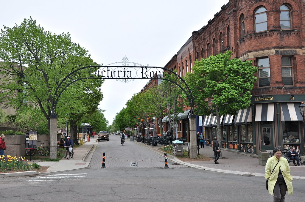
During lunch, we studied the map (not the above one!) and noted the places that we hadn't yet visited in preparation for a return visit. Here are some of those places in no particular order:
Victoria Road viewed from Queen Street
The statue of William Henry Pope at the waterfront
William Henry Pope was one
of the fathers of the Canadian Federation. He was Prince Edward Island's colonial secretary at the time that the Charlottetown Conference took place in
September 1864. That, along with the Québec
Conference held a month later and the London
Conference held in March 1867, led to the establishment of the Dominion of Canada that was proclaimed on 1 July
1867. He is depicted in the statue as being carried out to welcome the delegates in a rowing boat.
The brass shop was built in 1876 and is amongst the oldest buildings in Charlottetown. It was once used to polish
the brass components of locomotives. In the background is Roseport, a modern condominium.
The Railway Brass Shop at the Waterfront
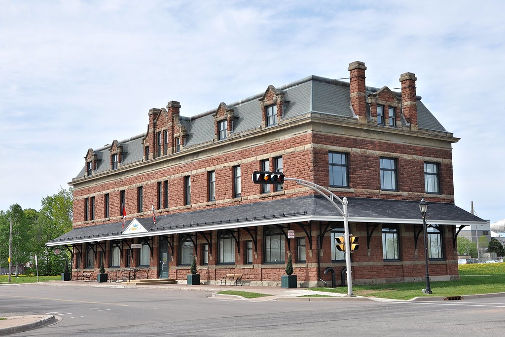
The former Canadian National Railways Station
The Station was the last place we saw in Charlottetown. As we walked back to the ship we reflected on what an iconic
place Charlottetown was. As it turned out, along with Québec City, it was one of the two most interesting places we
visited during our Canadian voyage.
Gaspé, Tuesday 2 June
Today we sailed northwards along the coast of New Brunswick to the Gaspé Peninsula in the Province of Québec and into an inlet called the Baie de Gaspé. In fact
the Bay is the estuary of two main rivers. One is the Rivière Matapédia which flows into the head of the Bay and the
other is the Rivière York which flows into the southern shore
of the Bay. The City of Gaspé lies at the mouth of the Rivière York and it was there that Black Watch berthed for the day. The main attraction
of the area is the Forillon National Park located
north of the Bay at the tip of the Gaspé Peninsula. A party of six of us including Paul and Val and a couple called
Mike and Judy hired a taxi to take us to the Park. We had a rather inadequate map at the time – nothing as good as
this one:
Forillon (courtesy Forillon Guide du visiteur 2015)
Basically we went round the head of the bay on Route 132 to just above Plage de Petit-Gaspe and back again.
Unfortunately, for most of the time, I had my camera on the wrong setting so my photos were very dark. The few that
I was able to enhance are included here. Otherwise the photos are from alternative sources each of which is duly
acknowledged.
First we travelled west to the head of the bay where we saw the Sanctuary of Notre Dame des Douleurs. It's quite an interesting spot so, should you be planning to follow in our footsteps, ask your driver for a photostop. Here's my photo of the Sanctuary taken from the taxi as we sped past:
Sanctuaire de Notre-Dame des Douleurs
From the graveyard of the Sanctuary you get a good view of the head of the bay and the road that took us to its
northern shore.
The head of Gaspé Bay from the graveyard of the Sanctuary
Reaching Saint-Majorique, we turned right and travelled along the northern shore to Penouille where we stopped for a
while. Penouille is a peninsular projecting about two kilometres south-west into the bay. A wooden walkway takes you
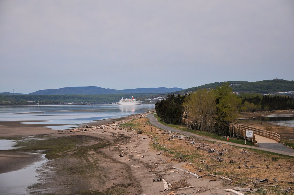
to the end, but we only went about halfway to a point where, looking south, we were able to see our ship. . .
'Black Watch' viewed from Penouille
Returning to the taxi we drove another 10 km to Cap-aux-Os where we saw the church of St John the Baptist. My photo of it was too poor to include here. This one is from Wikipedia:
Eglise de Saint-Jean-Baptiste, Cap-aux-Os (Charny, Wikipedia)
After another 3 km, the taxi stopped again and the driver suggested we walked eastwards along the coastline. We had
vague aspirations of reaching Cap Gaspe but, although we didn't realise it at the time, it's over 15 km so we hadn't
a hope! Had we done so this is what we would have seen:
Looking east from Mont Saint-Anne (Dennis Archer, Flickr)
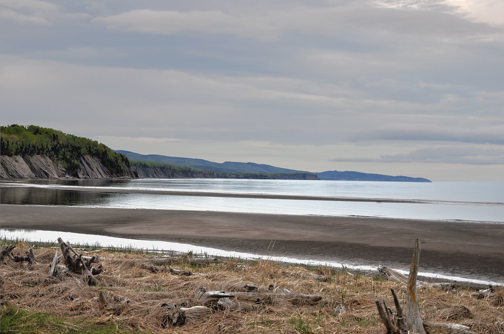
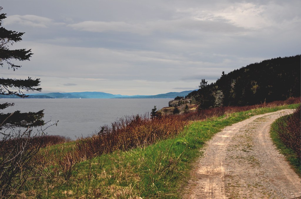
At least we got some good views across the Bay. This example is another much-edited photo:
Looking southwest from above Plage Petit-Gaspé
Returning to the road we saw our taxi driver awaiting us. On our way back we were lucky enough to see a black bear. We also saw some cubs. By the time I
was ready to photograph them they were five yards into the wood beside the road. What with their being in the
relative dark, and my camera being set incorrectly, the resulting shot was impossible to recover. Pity! This is
Val's shot of mother bear:
A black bear seen in Forillon National Park (Val Ruston)
It was our way back to Gaspé that I discovered that my camera had been set incorrectly. I reset it and was able to
take this photo of the city from across the estuary of Rivière
York:
As Black Watch sailed away from Gaspé we got a good view of the cape we had striven unsuccessfully to reach
by foot:
Cap Gaspé viewed from 'Black Watch'
Our day in Fornillon had been a little disappointing, mainly on account of our failure to reach Cap Gaspé. With the
benefit of hindsight it would have been much better not to have attempted this. We should instead have trekked only
a couple of kilometres along the path to the Cape before returning to Route 312 and asking the taxi-driver to take
us across the peninsular to its northern shore and west to Rivière-au-Renard before heading south along Route
197 back to to the Bay.
Trois Rivières, Thursday 4 June
Occasionally in what follows the French word ancien, meaning former, is used in the caption to a photograph of a building. Also, some of the links take you to French Wikipédia articles. Most can be translated into English by clicking on the English option at the bottom of the left-hand sidebar.
After a day sailing up the St Lawrence River we reached our next destination, Trios Rivières, on the northern shore
of the river about halfway between Québec City and Montréal. On our way we passed Québec. We were to visit the city
on the sixth and seventh of June after we had been to Trois-Rivières and Montréal. We berthed at Trois-Rivières
9.00am.
The City of Trois-Rivières was founded in 1634 and was the first settlement after Québec City in what was then the French colony of New France. It lies to the west of the confluence of the Saint-Maurice and Saint-Laurence rivers and, with a population of about 125,000, it's the fifth- largest city in the province of of Québec. The name Trois-Rivières derives from the fact that, as the Saint-Maurice River enters the Saint Lawrence, it divides into three streams, and in recognition of this, the people of the City are known as trifluviens.
Pauline and I began our walk round the City by ascending a flight of steps which had been built to commemorate its foundation:
As can be seen from the photo, the important stages in the history of the city are inscribed on successive steps. The first commemorates the foundation of the Fort of Trois-Rivières in 1634. At the top of the steps we saw further evidence of this in the form of a statue of Le Sieur de Laviolette. It was he who, in 1634, was despatched by the "Father of New France", Samuel de Champlain, to establish a trading post in what became known as Trois-Rivières. He was the first commander of the fort and is recognised as the founder of the city:
Trois Rivières, Thursday 4 June
Occasionally in what follows the French word ancien, meaning former, is used in the caption to a photograph of a building. Also, some of the links take you to French Wikipédia articles. Most can be translated into English by clicking on the English option at the bottom of the left-hand sidebar.
The City of Trois-Rivières was founded in 1634 and was the first settlement after Québec City in what was then the French colony of New France. It lies to the west of the confluence of the Saint-Maurice and Saint-Laurence rivers and, with a population of about 125,000, it's the fifth- largest city in the province of of Québec. The name Trois-Rivières derives from the fact that, as the Saint-Maurice River enters the Saint Lawrence, it divides into three streams, and in recognition of this, the people of the City are known as trifluviens.
East Trois-Rivières (courtesy tourismetroisrivieres.com)
(click on the map to enlarge it and press escape to return
or click Trois-Rivières Map for a map of a larger area)
(click on the map to enlarge it and press escape to return
or click Trois-Rivières Map for a map of a larger area)
Pauline and I began our walk round the City by ascending a flight of steps which had been built to commemorate its foundation:
Escalier Monumental, Trios Rivières (tourismetroisrivieres.com)
As can be seen from the photo, the important stages in the history of the city are inscribed on successive steps. The first commemorates the foundation of the Fort of Trois-Rivières in 1634. At the top of the steps we saw further evidence of this in the form of a statue of Le Sieur de Laviolette. It was he who, in 1634, was despatched by the "Father of New France", Samuel de Champlain, to establish a trading post in what became known as Trois-Rivières. He was the first commander of the fort and is recognised as the founder of the city:
Le Sieur de Laviolette
Another important date in the annals of the City was the Battle of Trois-Rivières in 1776 when British forces defeated the Continental Army that was formed by the
nascent United States after the outbreak of the American Revolutionary War. The army was led by General George
Washington and his aim was to bring Canada into the Union. It was the last major battle of the American invasion
fought on Québec soil.
A more poignant date was 1908. Until then Trois-Rivières resembled Vieux-Québec but, in June that year, a widespread fire razed much of the
city.
Returning to the present day and our walk, at the top of the steps we found ourselves in Rue des Casernes. A little
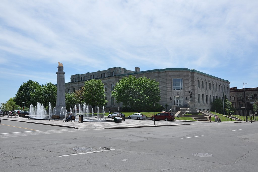
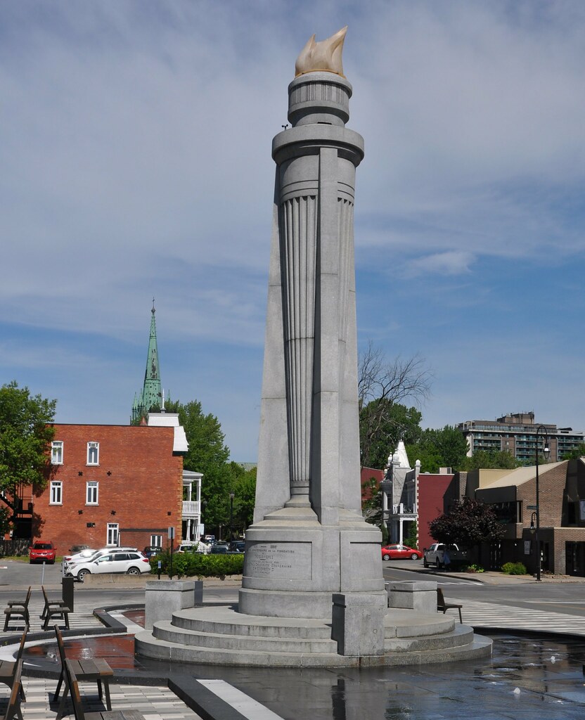
way in front of us was Place Pierre-Boucher, the centre-ville. There we saw the Post Office and a monument commemorating the 325th anniversary of the foundation of Trois-Rivières. At the top of that monument is a representation of a flame and, at its base, is an inscription revealing that it was unveiled by Queen Elizabeth on 24 June 1959:
Le Bureau de Poste
Monument du 325ème anniversaire
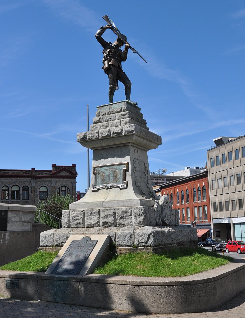
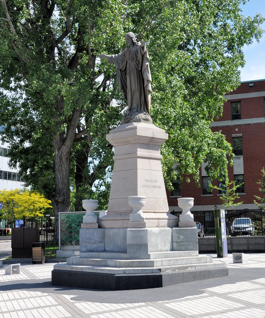
Also in Place Pierre-Boucher is the City's War Memorial and a statue paying homage to the Sacred Heart of Jesus Christ:
Le monument aux braves
Hommage au Sacré-Couer
Running north-east from Laviolette's statue is Rue
des Ursulines. It's the oldest road in the City and is at the heart of the small area where, in 1650, was
founded the fort of Laviolette later to become the city of Trois-Rivières. The road was originally called Rue de
Notre-Dame but was given its present name in 1947 to commemorate the 250th anniversary of the founding of an
Ursuline Convent there. Walking along the road, we noticed that the convent was only one of a number of interesting
in the road. They included an Anglican church, a college and a number of distinctive private houses. Fortunately,
these buildings had been spared by the great fire of 1908.
The Ursulines are Roman Catholic religious order
founded in 1535 in
Lombardy. The order takes its name from St Ursula, a British martyr who lived in late Roman or early Saxon
times. Its members are devoted to the education of girls and the care of
sick and needy. These functions were performed in homes that came to be known as Ursuline Convents. Serendipitely,
Ursula is Latin for a little
female bear, so the name is not inappropriate to a road that is in a region where
black bears may still be found.
When the Ursulines came to Trois-Rivières in 1697 they opened a school for girls. It was not their intention to open
a hospital but one was needed and the Bishop of Québec persuaded them to take on the task of providing it for a
few years. The "few years"turned out to be almost 200!
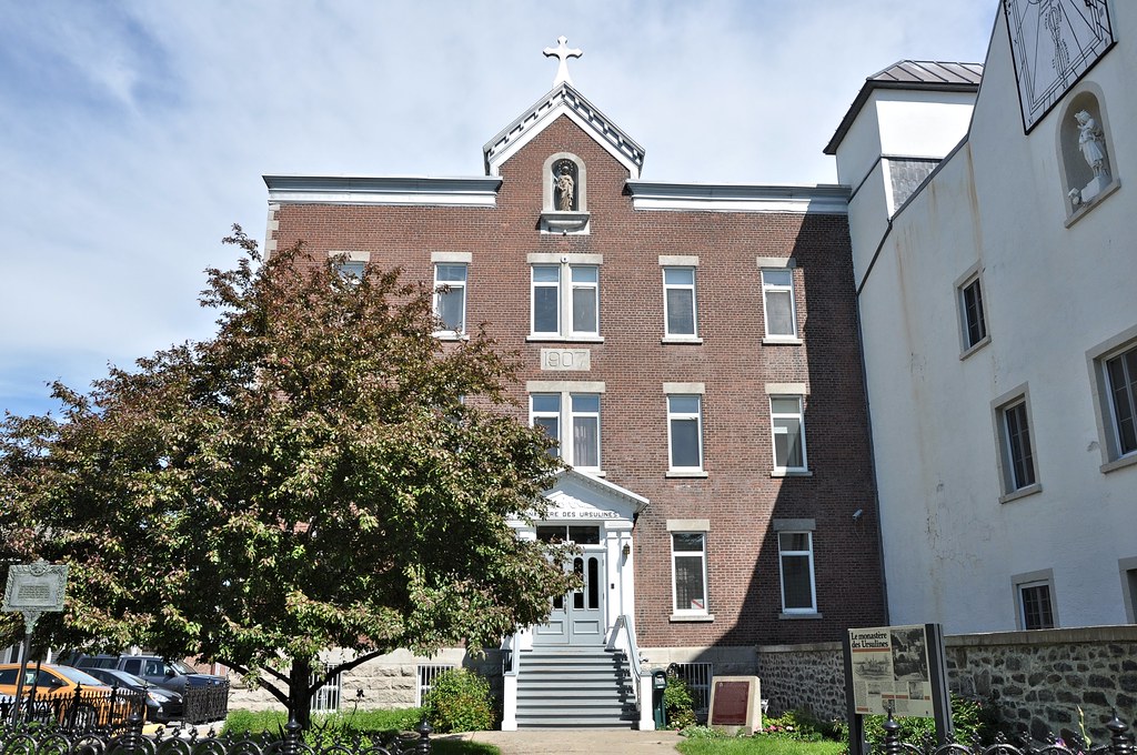
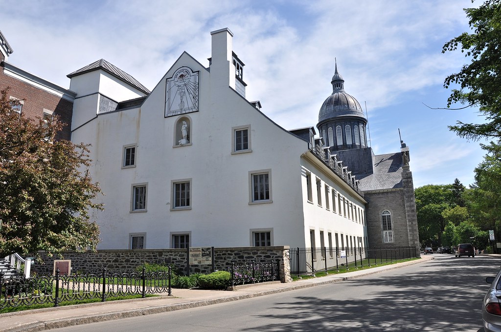
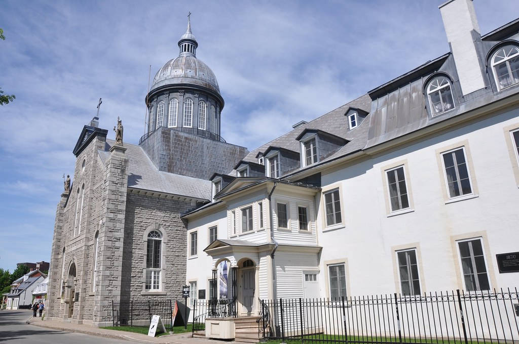
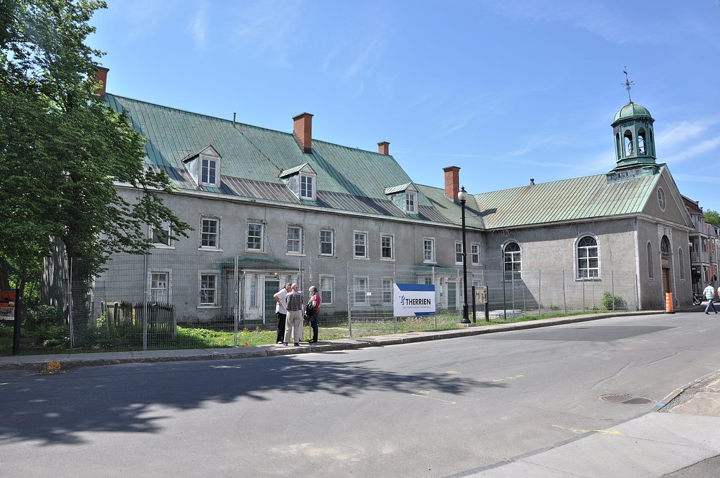
Nº 784: Le Monastère des Ursulines, built in 1907
Could this have been l'Ecole des Ursuline?
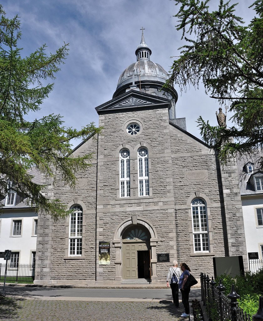
La Chapelle des Ursulines, built in 1715
The former Ursuline hospital abuts onto the church. It is now a museum. Unfortunately we didn't visit it – we should have!
Nº 734: Musée des Ursulines
Opposite the convent, looking across Parc de la Place d'Armes, we saw our ship.
On the other side of the road from the Ursuline complex is St James' Anglican Church. It was founded in about 1700
as the Couvent des Récollets. The Récollets were a French reform branch of the Franciscans and their order became established in New France during the 17th century. But the
Récollets did not endure in Québec Province and, after the death in 1776 of the last member of the its Trois-
Rivières branch, the convent was converted into the Anglican church and dedicated to St James. It's the
oldest Anglican parish in Québec province.
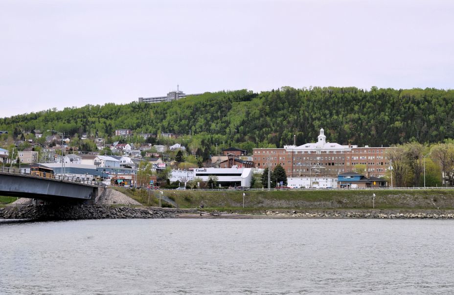
Black Watch berthed in Trois-Rivière
Nº 802: St James' Anglican Church, built in about 1700
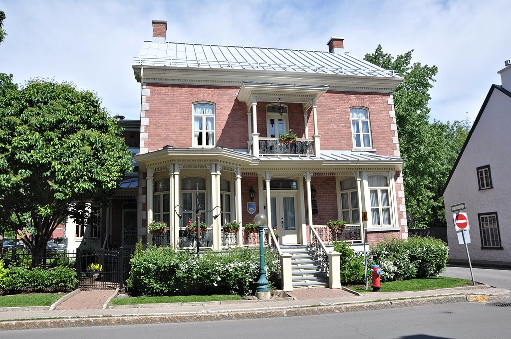
On our way to the convent we had seen a few relatively modern buildings in the form of dwelling places:. Here are
two of them:
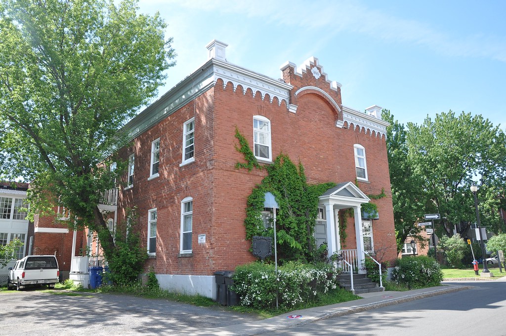
Nº 836, built in 1880
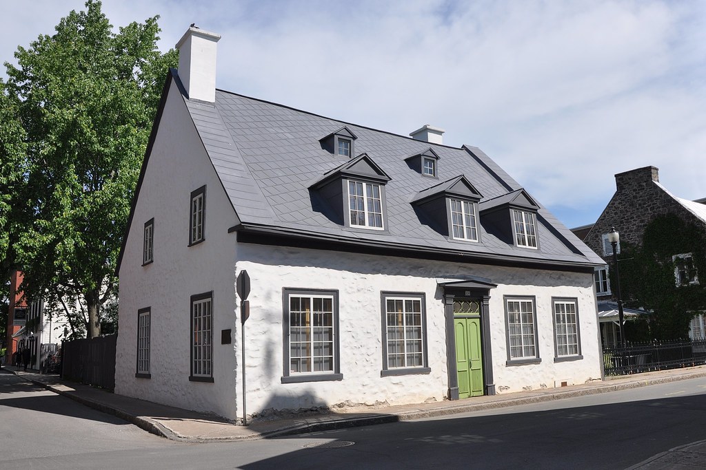
Opposite St James's Church there were two much older houses. Number 834 is one of the oldest in Canada. It was
built in 1756 by Georges de Gannes, A
Québécois officer who lived during the the time of French regime. He lived in the house for almost 20 years
before departing for France.
Nº 834, built in 1756
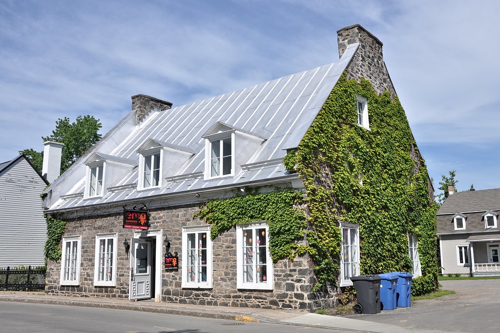
Number 802 is known as the Maison
Hertel-de la Fresnière. It was built by Joseph-François Hertel de la Fresnière, a Québécoise soldier
born in 1642. He acquired the land in 1668 but the house was not built until the 1820s. After that it
remained in the Hertel de la Fresnière family for over a hundred years. It was purchased by the municipality of
Trois-Rivières in 1970.
Nº 802, built between 1824 and 1829
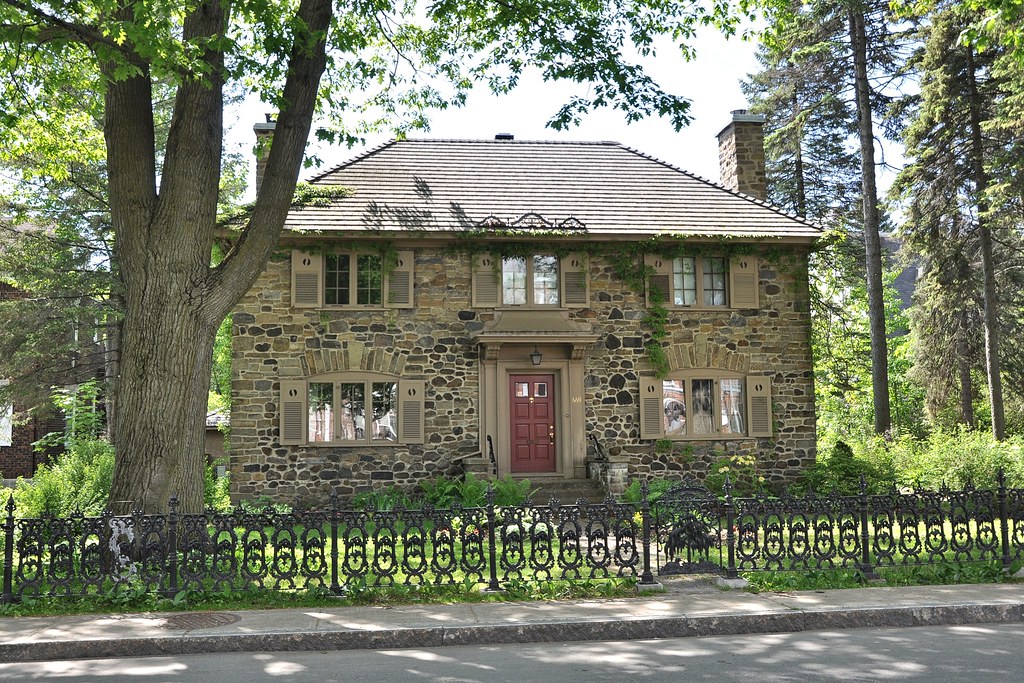
Nº 669, built in 1917
At the end of the road is a much more modern house – only 100 years old! Nevertheless it blended well into the
environment:

Nº 669, built in 1917
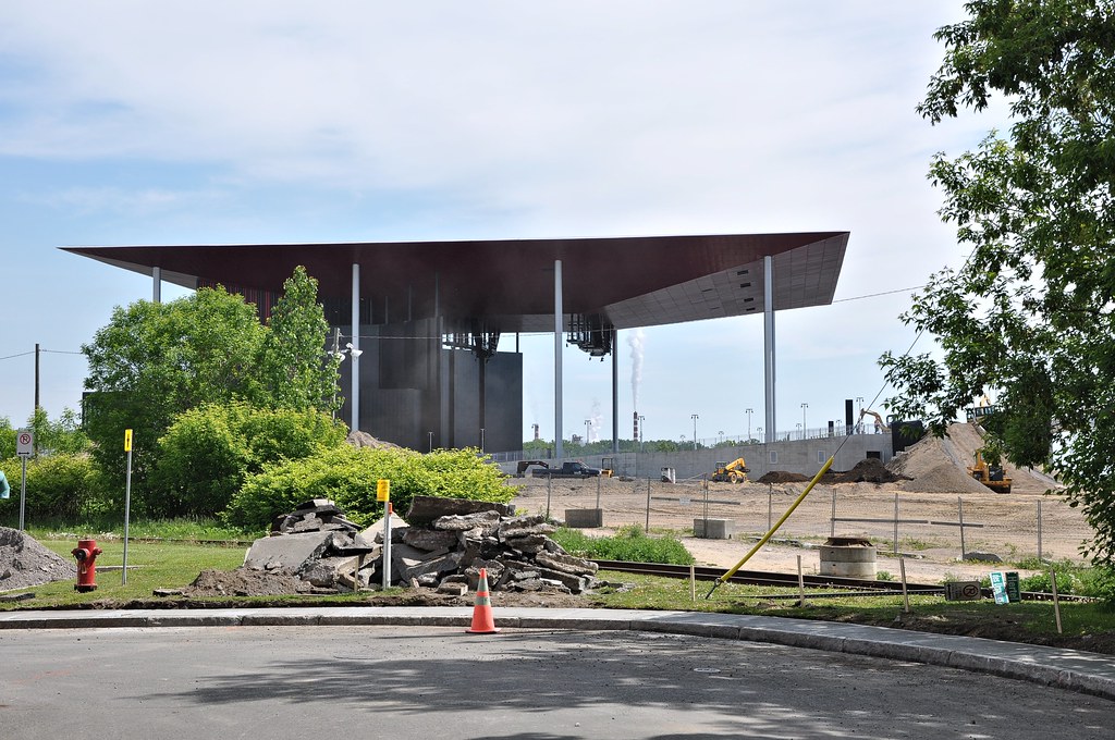
At the far end of Rue des Ursulines, at the confluence of the St Maurice and St Lawrence rivers we saw a large building that was in the course of construction:
Construction of l’Amphithéâtre Cogeco
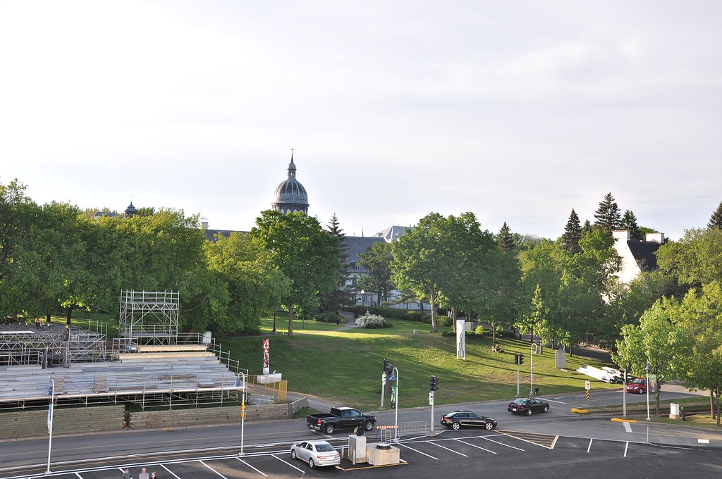
The building – the Cogeco Amphitheatre – was completed in mid-July, some six weeks after we saw it. It has a total area of 14,000 m² (150,700 ft²) with 3500 seats and 5500 standing room on a grassy esplanade for a total of 9000 spectators. This is what it looked like just before it was opened:
L’Amphithéâtre Cogeco in early July 2015
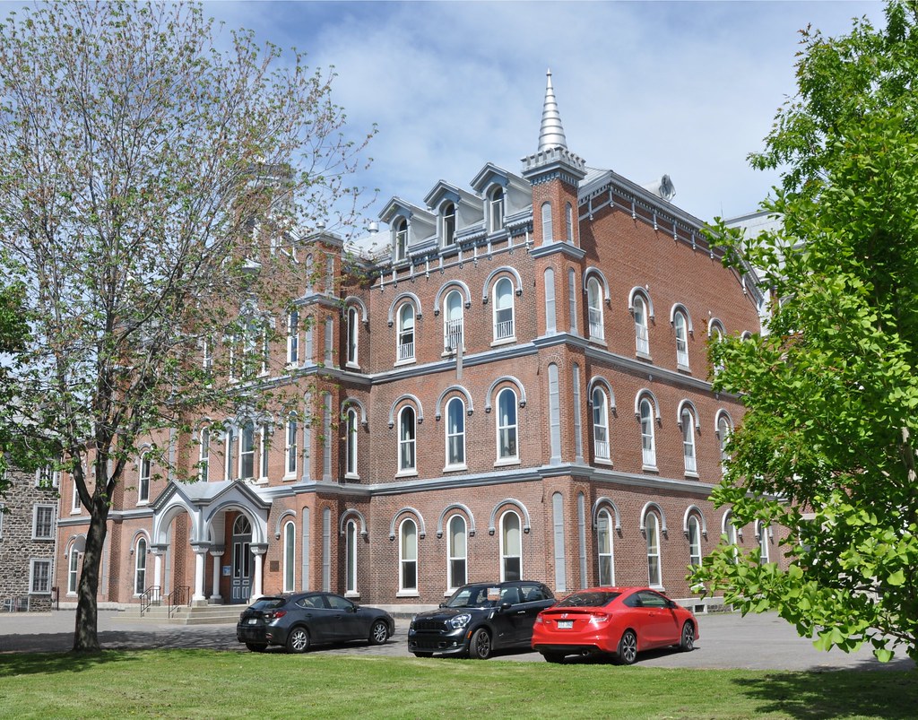
Walking back along Rue des Ursuline, we stopped at its junction with at Rue Sainte Cécile. There, alongside the museum, we saw a symmetrical, three-storey, red-brick building. This is how it appears from Rue des Ursulines:
L'ancien Pensionnat du Sacré-Coeur
It's the oldest of a collection of academic buildings constructed in the late 19th and 20th centuries. It was originally built as a boarding school named after the Sacred Heart. At some time during the 20th century, a private mixed school the
The main building of the school is more modern. It lies behind the red-brick building and has its entrance in Rue Hart. Had we walked further along Rue Sainte Cécile, we would have seen it. So here's a photo from the school's website:
Main building of Collège Marie-de-l'Incarnation
Instead, we returned to Rue des Ursulines and retraced our steps. Just past the monastery we turned right into Rue Saint François Xavier. Was originally built in 1672, soon after Rue des Ursulines but there are very few if any old buildings so presumably they were victims of the 1908 fire. Just past Rue de Tonnancourt there is a Church of England cemetery. It’s the only survivor that we could find of three that were once along the road, the other three being the Jewish and the Methodist cemeteries.
Church of England Cemetery. Here's the Church of England one in a Google Street view image:
Cimetière St-James, inaugurated in 1810 (Street View)
300 yards after the cemetery we saw this building on our right:
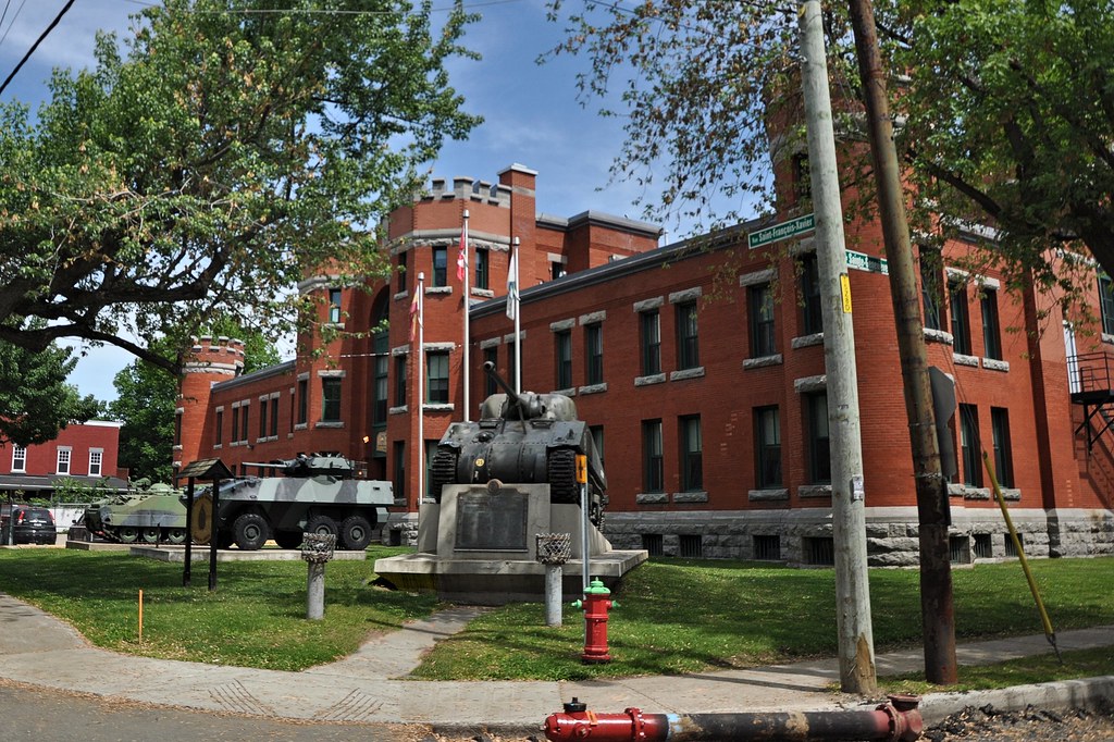
Musée Militaire de Trois-Rivières
Above the door was a plaque:
A Manège by most definitions, is a either a riding school or a merry-go-round. The latter seems
highly unlikely so one is forced to the conclusion that the General ran a riding school in Trois-Rivières in his
retirement and it it was here. But I went all the way round the building and there was no evidence of their being
enough room for a riding school so it's a mystery awaiting solution.
Jean Victor Allard (1913-1996) was an accomplished officer in the Canadian
Army who served with distinction in WWII. He became the first French Canadian to become Chief of the Defence Staff,
the highest position in the Canadian forces and was also the first to hold the rank of general. Though born in
Nicolet, a suburb of Québec, he spent his later child and retirement in Trois-Rivières and it was, in his own
words, "a city to which I have been attached since childhood" [The memoirs of General Jean V. Allard, 1988]. The
tanks outside appropriately enough give the building a military aura, but the significance of manège is
is a mystery because translated literally it means riding school. In fact, it's now the museum of the
12th Armoured Regiment of Canada that was founded in 1871. It features exhibits of the military history of Trois-
Rivières, Canada and elsewhere in the world. But it was closed!
Although we were now about a half a mile from Rue des Ursulines, the Military Museum was the only interesting building
we'd seen – and it was another half mile before we came to anything worth photographing. Then we came to Boulevard du Saint Maurice where we saw a large
church:
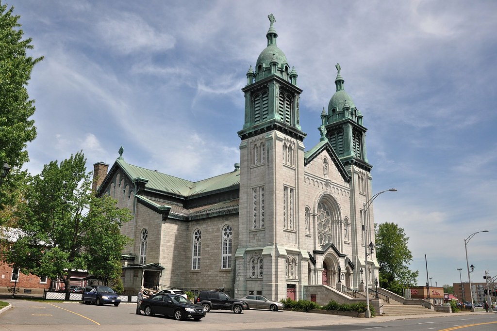
L'Eglise Notre-Dame des Sept Allegresses
It was founded by the Franciscans who came to Trois-Rivières in the early 1880s. It's dedicated to the Seven Joys of the Virgin
Mary and was consecrated in 1911. Further along, Rue Saint François Xavier led to what looked like
modern suburbia. So we turned left into Boulevard du Saint Maurice and soon we came to this building:
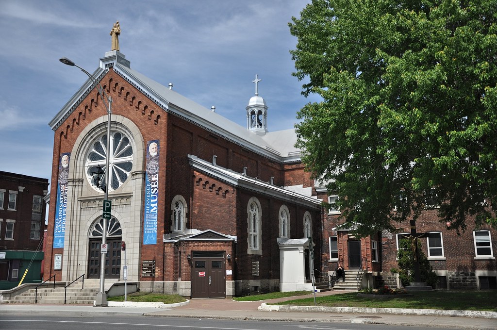
It was originally Chapelle St Antoine but is now a museum dedicated to the memory of an amazing Franciscan called Père Frédéric Jansoone 1838-1916). It was
he who was largely responsible for the building of Notre-Dame des Sept
Allegresses. He was beatified by Pope John Paul II in 1988. We visited the museum. I could take
no photos as the flash on my camera is not working but there are some on the museum's website. Click on Galerie de
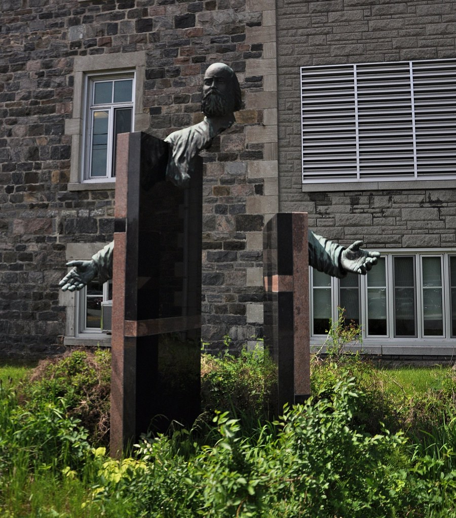
photos. Here's a photograph of the saintly Père Frédéric:
From the museum we turned left into Rue Sainte Julie. We were now walking back towards the Saint Lawrence. After a while we saw a huge domed building across the car park on our left:
From the museum we turned left into Rue Sainte Julie. We were now walking back towards the Saint Lawrence. After a while we saw a huge domed building across the car park on our left:
Séminaire St-Joseph
Opposite the car park on the right we saw this strange edifice:
It was just in front of the the CSSS de Trois-Rivières (Centre de Santé et de Services Sociaux or Centre for Health and Social Services).
L'ancien Hôpital Saint-Joseph et le CSSS de Trois-
Rivières
The ochre building in the foreground is the former hospital of Saint Joseph. The CSSS has incorporated it into a much larger, largely grey-stone complex. If you enlarge the view you should be able to see a statue at the top of the far building. I believe it's Saint Joseph himself.
After continuing for a while along Rue Sainte Julie returned the right when we reached Rue Royale. Not far along the road is the Cathedral of the Assumption (translation not available):
Cathédrale de l'Assomption
 Cathédrale de l'Assomption (Stéphane Batigne, Wikimedia) |
(Griffindor, Wikimedia) |
The first mass was celebrated in Trois-Rivières on 26 July 1615 by a priest of the Récollet order but it wasn’t until 1678 that the first wooden church was built. It was replaced in 1692 and again in 1709, this time by stone structure. Unfortunately that building was a victim of the 1908 fire.
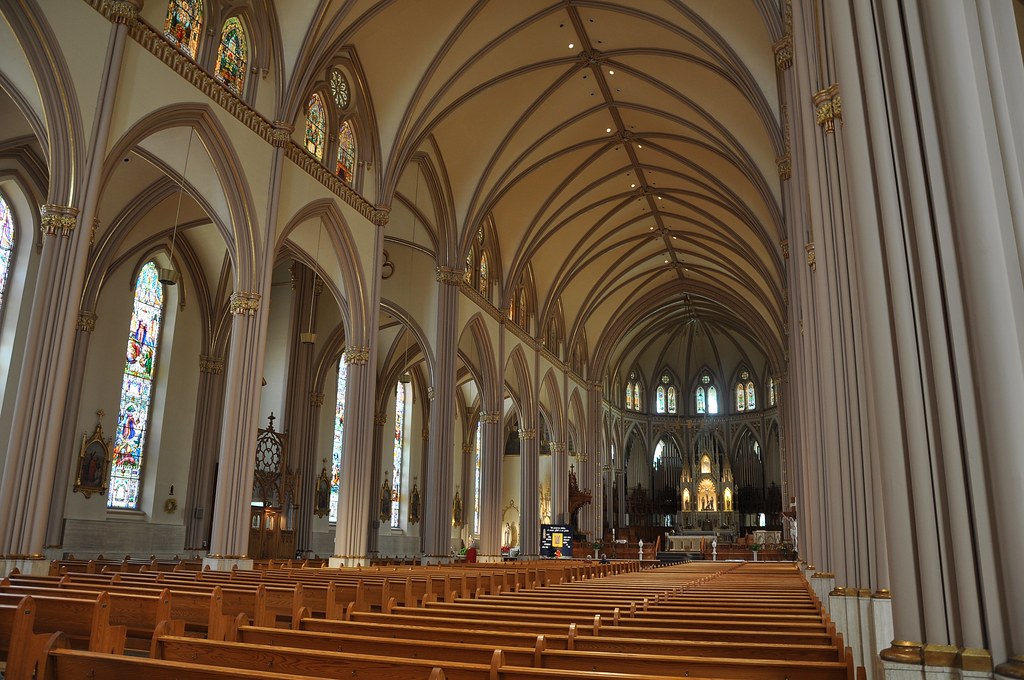
On June 8, 1852, Trois-Rivières was created a bishopric by Pope Pius IX. Bishop Thomas Cooke became the first bishop and on March 16, 1854 that he instigated a project to construct a cathedral. The resulting neo-Gothic building was inaugurated on 29 September 1858 complete with a superb organ. The architect was Victor Bourgeau and his design – both the exterior and the interior – was heavily influenced by Trinity Church Manhattan. Here is the interior:
Intérieur de la Cathédrale
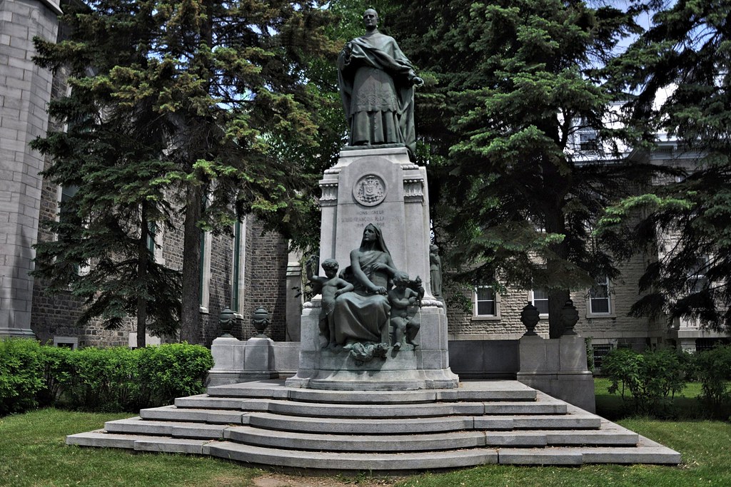
After the Cathedral we turned right into Rue Bonaventure and just past the cathedral we saw a statue of Louis-François Laflèche (1818-1898), Bishop of Trois-Rivières from 1866 until his death at the age of 79 in 1898. Here he is:
Monseigneur Louis-Francois Richer Laflèche
Behind the statue is the Bishop's Palace. It was built between 1879 and 1881 so it must have survived the Great Fire. This image is from an old post-card:
Évêché de Trois-Rivières
Maurice le Noblet Duplessis
The Québec flag beside the statue was at half-mast. We have seen other flags similarly hung and we saw many more
when we reached Montréal and Québec City. We later made enquiries later as to why this was and it turned out that an
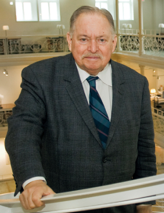
important Québecois politician, Jacques Parizeau, had
died on 1 June. He was born in Montréal in 1930 of a very wealthy family, spent time in Europe as a young man where
he gained a PhD from the London School of Economics and further degrees from Parisian institutions. He was leader of
the Parti Quebecois from 1987-1996 and, like
Duplessis, served as Prime Minister of the Province – in his case from 1994-1996.
Jacques Parizeau in
2008
(Webmasterfonds, Wikimedia)
Although Jacques Parizeau, GOQ, PhD, was an accomplished economist, he will best be remembered for having been a
fervent Québec sovereigntist. He
could well have been present when, in June 1967, Charles de Gaulle shouted "Vive le Québec libre!" during a speech
from the balcony of Montreal's City Hall. This gave a great fillip to the separatist movements in Québec but it
deeply offended the Federal Government and Canadians of British descent who saw it as showing contempt for the
sacrifices of Canadian soldiers made on the battlefields of France in two world wars. De Gaulle’s visit was hastily
terminated. Nevertheless, from that day on, separatist movements such as the left-wing Front de liberation du Québec
flourished and, in October 1995, during Parizeau’s watch, a referendum was held on whether Québec Province should
leave the Federation. It was the second referendum on whether or not Québec should secede. The first, in 1980, had
been lost by 40% to 60%. In 1995, out of just over five million voters, the opponents of secession won by 54,228
votes – a hair’s breadth! Parizeau made some unfortunate remarks on the night of the referendum and, immediately
after the result, tendered his resignation both as Prime Minister and as leader of the Parti Québecois. Both
resignations took affect in January 1996.
For all the strong feeling on the matter of secession which must still prevail in Québec, whilst we were in the
province we felt not a trace of animosity. In fact we found them amongst the most welcoming people we had met.
The house that we saw in the garden as we were walking along Rue Bonaventure is the Manoir Boucher-de
Niverville.
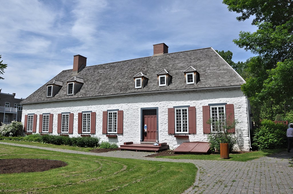
Manoir Boucher-de Niverville
It's one of the oldest houses in the City outside the area around Rue des Ursulines. It was built in 1668 by Jacques LeNeuf de la Potherie, a merchant from Normandy who was four times Governor of Trois-Rivières. In 1729 it was acquired by François Chastelainan officer of the French Marines who left it to his daughter and son-in-law, Joseph-Claude Boucher de Niverville. Later it passed through the hands of a number of owners. It was miraculously saved during the Great Fire but subsequently was abandoned and fell into decay until, in 1940, it was acquired by the municipality of Trois- Rivières.
Leaving the garden, we walked the short distance to Rue Notre Dame, Trois-Rivières' main shopping thoroughfare. Here is a Street View:
Rue Nôtre Dame, Trois-Rivières, Street View
Rather than explore Rue Nôtre Dame, we returned to Black Watch for lunch. Afterwards we decided to take a look at the three rivers themselves. We walked along Promenade du Parc Portuaire across the little park and
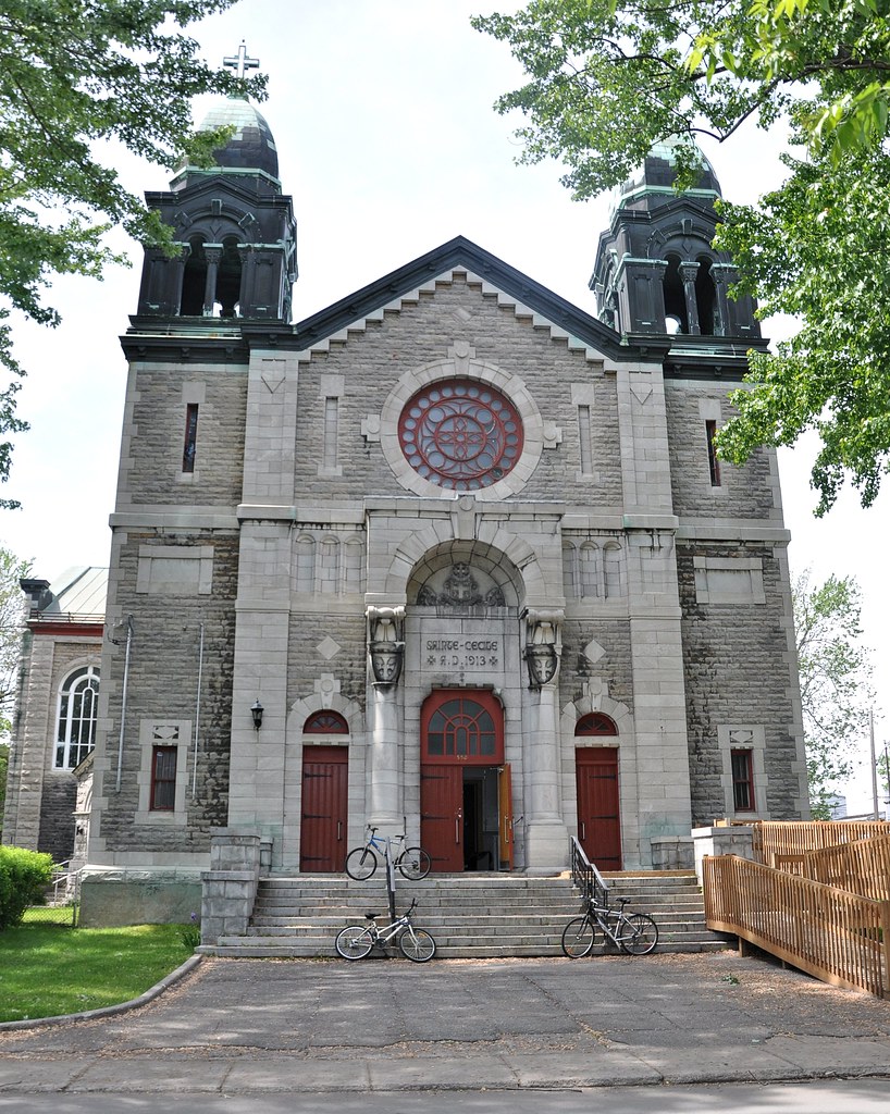
back to Rue des Ursulines. Continued to its end, we turned left into the rather uninspiring Rue Hertel. However, when we reached Rue Commissionaires, we saw a large building some way to our left. It was the former Church of St Cecile:
Eglise Saint-Cecile
It was built as a Catholic Church in 1913 and 1914 but fell into disuse. In 2011, it was purchased by the
Spect-Arts Corporation who converted it into a cultural centre open
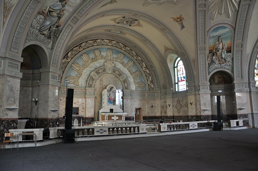
for rentals of all kinds. The interior of the church is quite impressive:
L'intérieur du Eglise Saint-Cecile
Having checked out St Cecile, and continued along Rue Hertel. We soon reached Parc Béliveau and Parc Saint- Paul. We walked across the parks, into Rue Saint Paul and on to Boulevard Sainte Maurice. To our right we could see the Duplessis Bridge.
Pont Duplessis looking downstream(Fralambert, Wikimedia)
The above view is looking downstream from the Dupessis Bridge. To the left are the two smaller streams, one passing under each of the ends of the bridge. To the right is the main stream.
The main stream of Rivière Sainte-Maurice
Two of the three streams of the Saint Maurice River
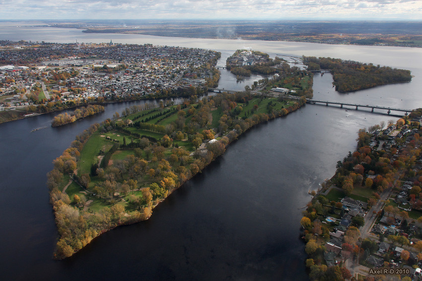
To get a full appreciation of the "Three Rivers" you need to be in a helicopter – as was lucky Axel Drainville in October 2010:
The confluence of the St Maurice and St Lawrence rivers
(Axel Drainville, Flickr)
On the right, connecting Trois-Rivières proper with Île Saint-Christophe (the large central island), is the
Duplessis Bridge. We only went two thirds of the way along yet we thought we were seeing the three proverbial "three
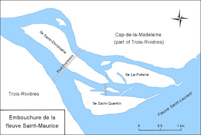
rivers". We weren't! This map shows how we were deluded (click to enlarge):
Mouth of the St Maurice River
When I took my second shot, we were two thirds of the way along the section of Pont Duplessis between Trois-Rivières
and Île Saint-Christophe and were looking downstream along the channel between that island and Île Saint-Quentin.
Seeing the little bridge between the two islands and the islet halfway along the bridge, we misguidedly thought the
streams either side of the islet were two of the "rivers". Accordingly, we turned back. Had we walked further we
would have seen the northern "river".
By turning back we also missed seeing one of Canada's iconic buildings, Basilique Notre-Dame-du-Cap (the Basilica
of our Lady of the Headland). It's on the bank of the St Lawrence about 1 km off the map. You can see it on
Axel's aerial shot towards the top left, half way along the shore from the St Maurice to the edge of the photo. The
return journey would have been eight miles and we had neither the time nor the energy.
Basilique Notre-Dame-du-Cap (Tango7174, Wikimedia)
A chapel was built on the site in between 1717 and 1720. In 1878 it was decided to replace it with a larger church.
There were no suitable stones in the vicinity so they had to be brought from the other side of the St Lawrence. By
what is considered a miracle, an ice bridge formed across the river in March 1879. The stones were conveyed across
it and the new church was consecrated in 1880.
Work on the building of the Basilica – then designated as a sanctuary – was started in 1955. It was consecrated as a
minor Basilica in 1964. It has since been designated as one of only five national shrines of Canada. Every year it
attracts thousands of pilgrims and visitors.
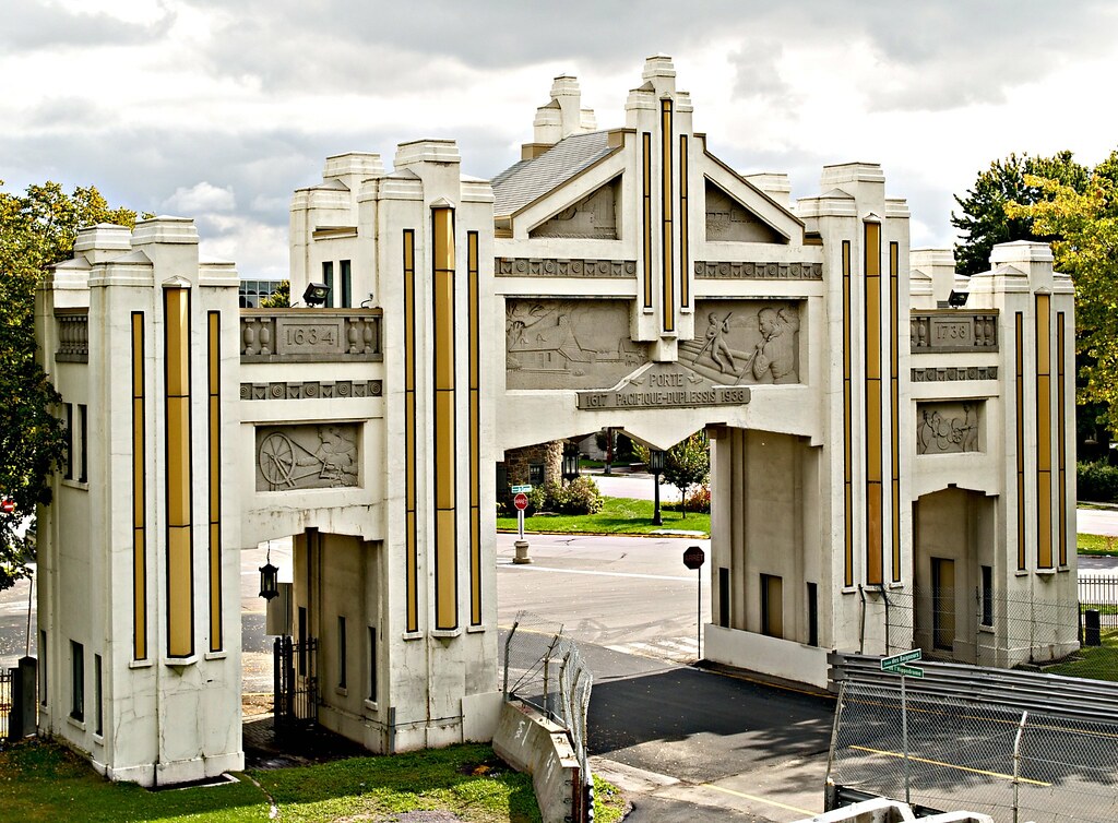
Porte Pacifique-Duplessis
It wouldn't have involved such a long walk as the Basilica as it's situated in Parc de l'expoition, about one and a half miles northwest of where Black Watch was berthed. However, we didn't find out about it until we were back in Bristol.
By the time we reached the ship we were pretty exhausted. Fortunately tea was still on the go, so we sat down
and enjoyed it. Before sailaway I took a photograph from the ship of the Ursuline Convent looking across Parc
du Jardin des Ursulines:
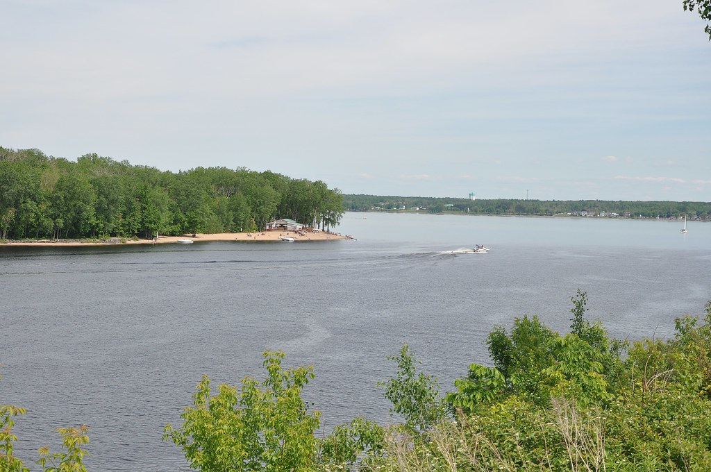
From the other side of the ship I took this shot looking across the St Lawrence:
Sainte Angèle de Laval
It's the village of Sainte Angèle of Laval in the municipality of Bécancour. Here is a closer view showing the church more clearly:
L'Eglise Sainte Angèle
(Fralambert, Wikipedia)
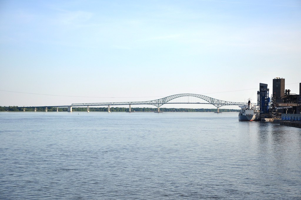
As we sailed upstream towards Montréal we passed under Pont Laviolette:
Pont Laviolette
It's an arch bridge carrying Autoroute 55 over the St Lawrence and is named after the founder of Trois-Rivières. It
was built between 1964 and 1967. During construction an explosion resulted in the bursting of a caisson caused the death of twelve workers. It's
the only bridge across the river between Montréal and Québec City.


